

Story highlights
Erika shouldn't strengthen much and could weaken some over the next two days
Many islands in the eastern Caribbean are under tropical storm warnings
One forecast suggests Erika could strengthen into a weak hurricane when it hits South Florida
After spinning west across the Atlantic, Tropical Storm Erika finally has land in its sights.
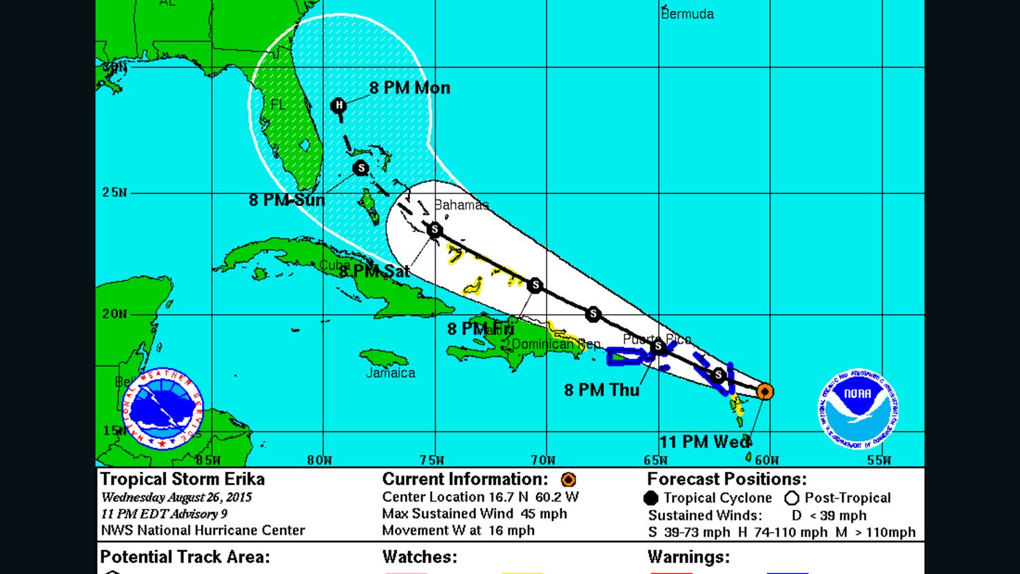
Erika will start moving over islands in the eastern Caribbean Sea overnight Wednesday, according to the National Hurricane Center’s 11 p.m. advisory. The storm was centered about 110 miles east-southeast of Antigua. Its next stop after that, on Thursday, will be in and around the Virgin Islands, before heading near the northern coast of the Dominican Republic on Friday.
Tropical storms and hurricanes: Fast facts for 2015
This progression has led forecasters to issue tropical storm warnings – meaning sustained winds of 39 mph or more are expected in the next 36 hours – for numerous island locales including Anguilla, St. Maarten, St. Barthelemy, Montserrat, Antigua and Barbuda, St. Kitts and Nevis, Puerto Rico and both the U.S. and British Virgin Islands.
The bad news is that this means islanders and vacationers will get soaked and then some. The hurricane center predicts 3 to 5 inches of rainfall, with as many as 8 inches in some locales.
The good news is that while Erika’s winds will be strong, they’ll be far short of historic. As of Wednesday night, the storm sported sustained winds of 45 mph gusts and was described as “poorly organized.” And it shouldn’t get much worse anytime soon, with the forecast calling for “little change in strength or perhaps some slight weakening … during the next 48 hours.”
That doesn’t mean Erika – the fifth named storm of the Atlantic hurricane season – will sputter out.
By the end of the week, forecast models predict that the storm will intensify. Erika is expected to reach hurricane status with 75 mph sustained winds as it approaches South Florida on Monday.