New Englanders hit by the weekend’s nor’easter will barely have time to clean up before another storm could strike this week.
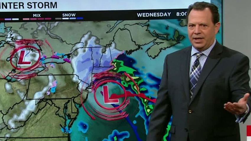
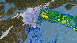
A Midwest storm is expected to combine with low pressure moving out of the Southeast to create a coastal low – and likely another nor’easter for Wednesday into Thursday. Winter storm watches already cover more than 33 million people, including New York City and Boston.
While the winds don’t look quite as strong as this most recent storm, this next one is forecast to be more of a classic nor’easter, with heavy snow possible for the major metropolitan areas.
The biggest impacts from the storm will likely be from Wednesday into Thursday morning.
In addition, while last weekend’s deadly nor’easter has moved offshore, high tides are expected early Monday on the New England coast.
The National Weather Service in Boston said in a tweet that winds are likely to remain an issue through Monday and that it’s monitoring for a potential nor’easter midweek.
Latest developments
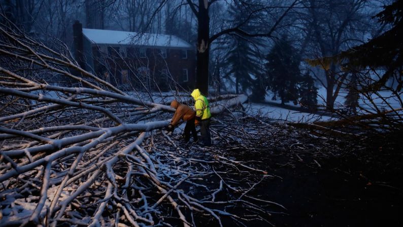
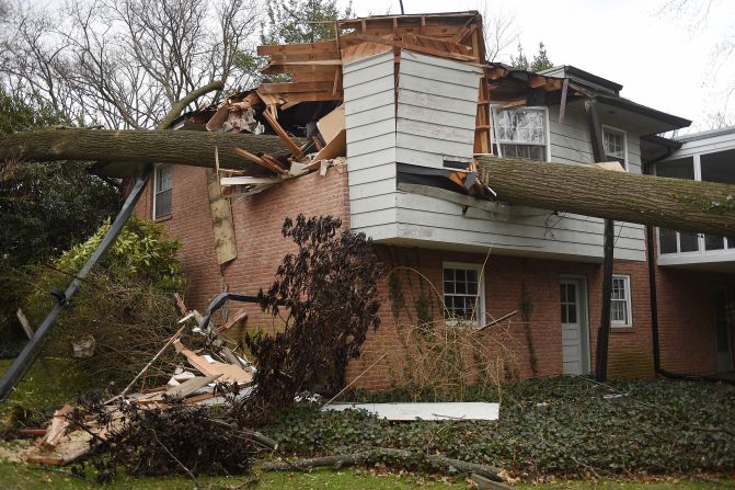
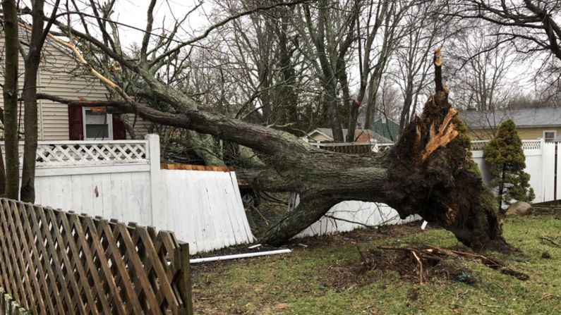
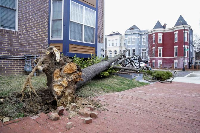
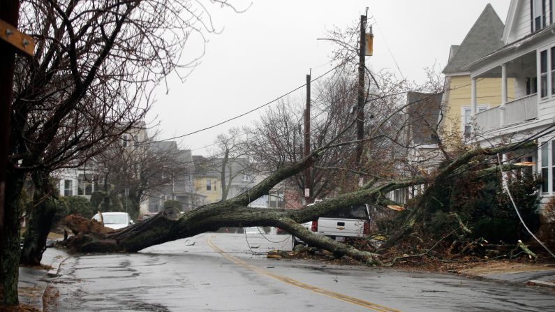
• Deaths: At least seven people were killed by falling trees in recent days, including at least one child. Two people died in Virginia, one in Maryland, one in Massachusetts, one in New York, one in New Jersey and one in Rhode Island.
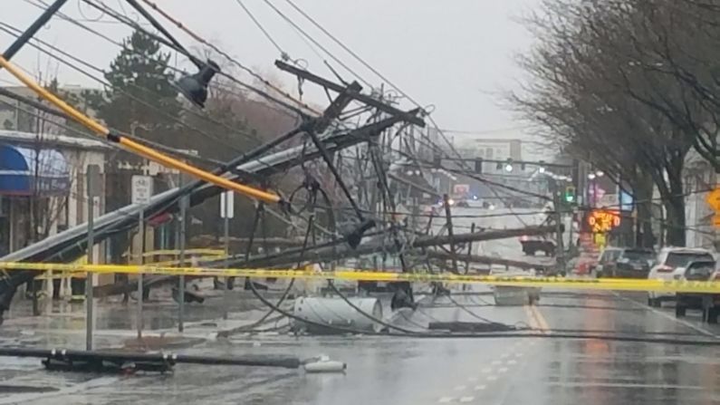
• Power outages: More than 215,000 customers from Virginia to Massachusetts were still without power as of Monday morning, including 74,280 in Massachusetts.
• Train services: Amtrak said all its services between Boston and Washington, D.C., will resume Monday after storm-related cancellations Friday. On Sunday, “nearly all” service had resumed, Amtrak said.
Weak phone connection? Click here to read text-only versions of CNN’s top stories.
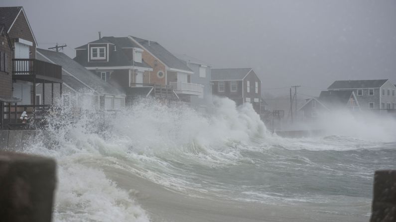
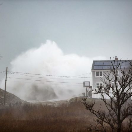
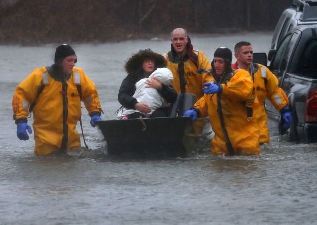
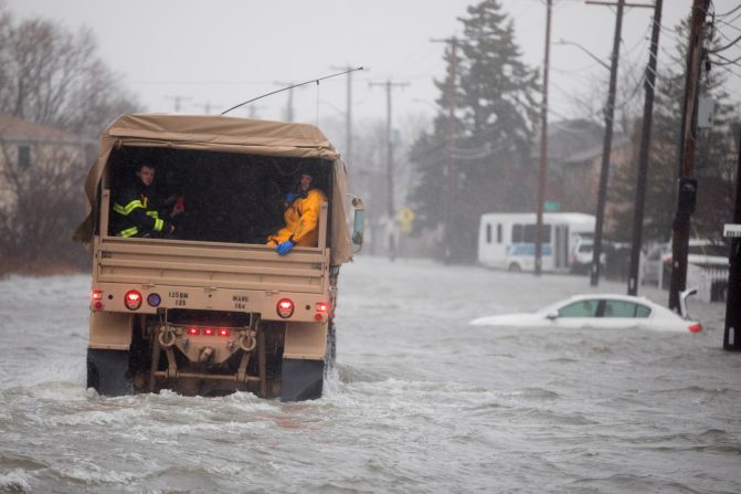
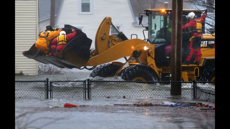
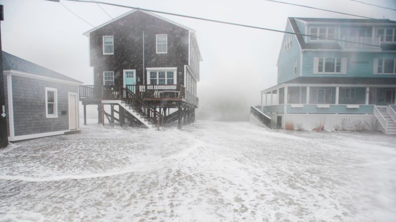
Homes underwater
“The beach is all over the front yard – we have shingles from everyone else’s house but the house we are at actually withstood the storm pretty well,” Frank Wilkins of Marshfield, Massachusetts, told CNN affiliate WFXT.

'Bomb cyclone' hammers East Coast
In the aftermath of the storm, not every hazard is visible.
“Driving around, it’s dangerous. There’s a lot of trees laying against wires and intersections you can’t see,” said Butch Welch of Marshfield. “The lights are out at the intersections … it’s scary.”
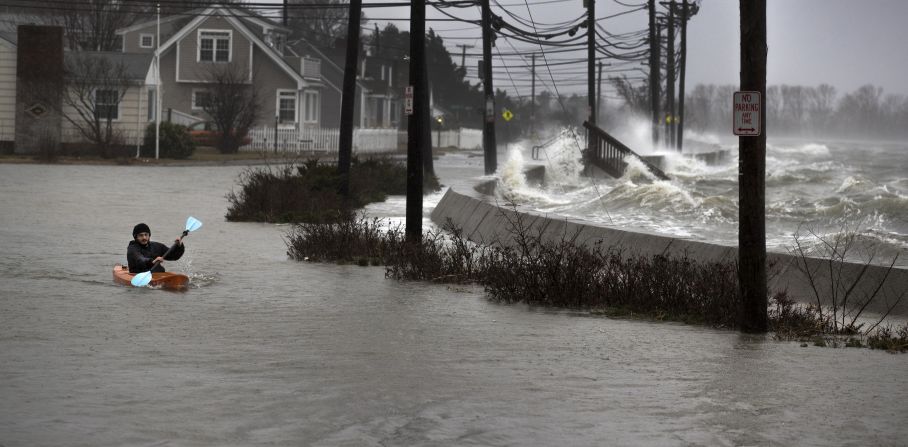
In Massachusetts, Quincy police Capt. John Dougan said it’s the worst flooding he’s seen in years.
“We’re seeing homes underwater, their basements were flooded out, the electricity was off,” he said.
On Sunday, Massachusetts Gov. Charlie Baker visited several cities including Quincy that had been pummeled by the storm. Baker had declared a state of emergency on Saturday.

The National Weather Service said gusty winds and coastal flooding will diminish as the storm pulls away from the Atlantic coast. Emergency officials urged residents on higher ground to stay indoors, even after the storm pushed out.
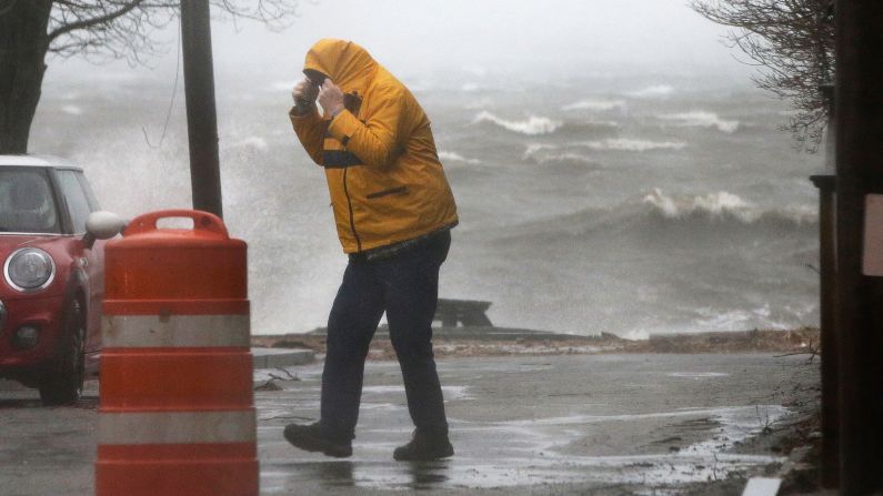
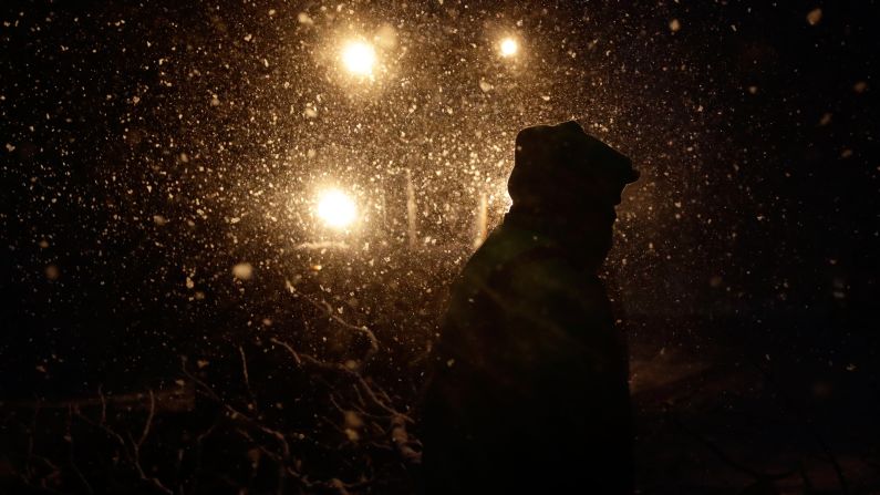
The storm morphed Friday into a “bomb cyclone” after undergoing a rapid pressure drop known as bombogenesis. It slammed much of the Northeast with heavy snow and rain, prompting significant coastal flooding and hurricane-force gusts in New England.
Winds along parts of the Massachusetts coast whipped in excess of 90 miles per hour during the storm.
The storm also dumped heavy snow from Ohio to New England and into upstate New York, where snow accumulations of more than 3 feet were recorded.
CNN’s Laura Ly contributed to this report.