
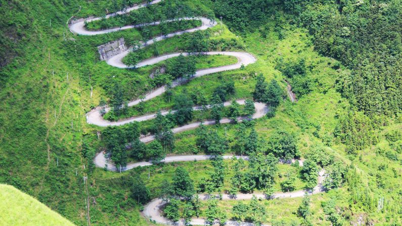
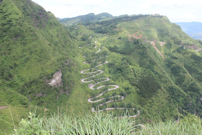


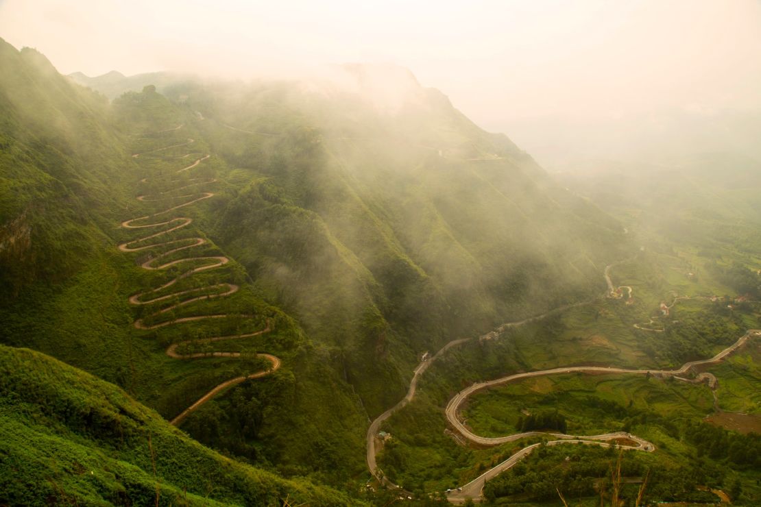
From a distance, the sharp bends look dizzying.
With 24 switchbacks – count them – the spectacular road twists and turns for two and a half miles up a remote mountainside in southwestern China. No longer in active use save for a handful of tourists and the occasional local on a motorbike, today the road stands quiet. But it once must have felt like a hair-pinned super highway.
During World War II, convoys of fully loaded US GMC military trucks snaked up the road transporting 15,000 tons of supplies each month to China’s wartime capital Chongqing.
In the opposite direction, it carried people fleeing Japanese troops.
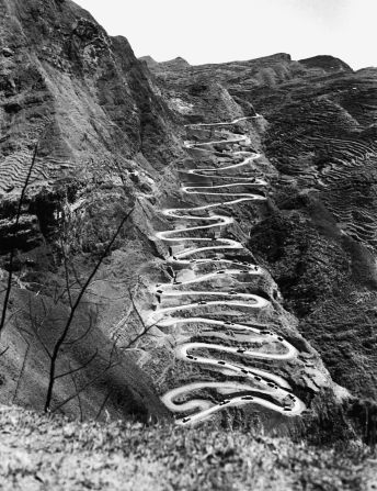
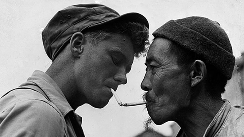
A black-and-white picture of the road appeared in US magazines like Life and it has since come to symbolize Chinese and US cooperation against Japanese occupation – an often forgotten chapter of that era.


‘Lost’
But, after the end of the war and the Communist victory in China, the location of the road in the striking picture was lost to historians for decades. A new road with fewer switchbacks opened in 1954 displacing the corkscrew route from the few maps that existed.
Many thought it was in northern Myanmar or the neighboring province of Yunnan – part of the wartime Burma Road that brought supplies from India to China as Japanese troops controlled the eastern seaboard.
In China, it’s known as the Stillwell Road after the US General Joseph Stillwell. Ge Shuya, a Chinese historian based in Yunnan, located the road near the town of Qinglong in 1995.
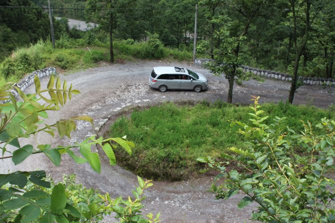
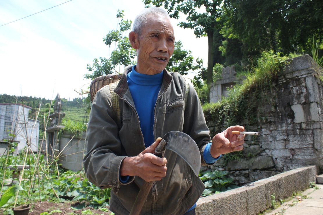
Of course, it’s remained a useful shortcut for locals like Yang Xuekun, a 75-year-old farmer whose simple, one-story home lies near the top.
Yang said the road was almost washed away by heavy rain in the 1970s but it was rebuilt. He still uses it to head out into the mountains and collect food for his pigs.
Buckle up
Driving the single-track road isn’t as perilous as it looks from afar. It climbs 1,150 feet (350 meters) in 2.5 miles (4 kilometers), meaning the ascent feels fairly gentle for a modern vehicle.
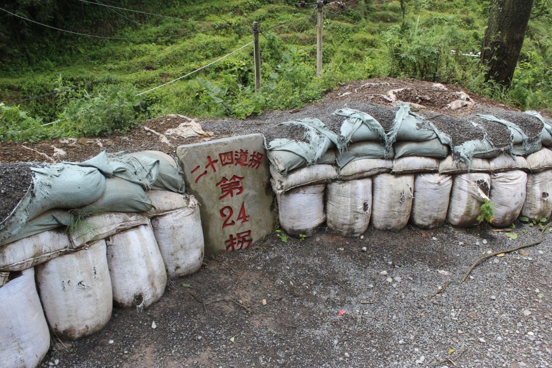
Each bend is anchored by a numbered way marker.
For the heavy wartime trucks and their passengers, however, it was still a risky journey – especially treacherous during the wet summer months.
Lin Kongxun, a former interpreter with the US 1880 engineer battalion that was stationed along the road, said traversing it was so dangerous many trucks overturned.
“Whenever the US drivers got onto the road, they prayed to God,” he told the People’s Daily newspaper in 2002.
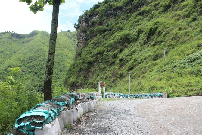
At the top of the graveled road – authorities want to keep it in its original state – is a military cemetery that offers a stunning view of the surrounding mountains and gorges
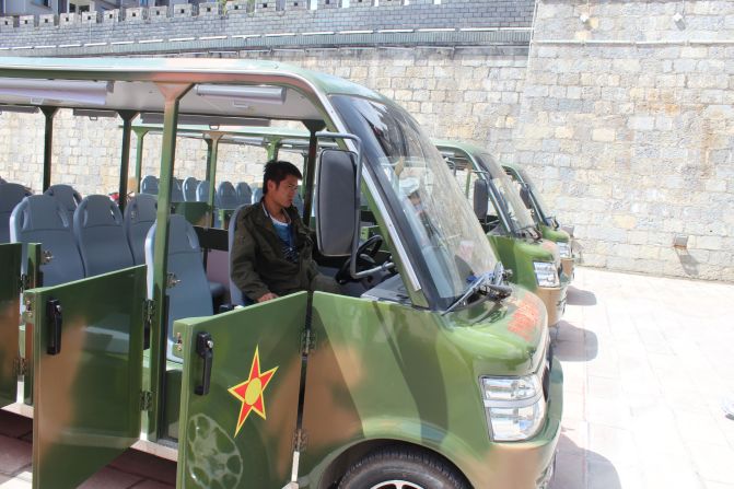
Beyond that is Qinglong, a scrappy town that was known in wartime as Annan. The city is keen to pull in tourists curious about the road and its unique history. For now, anyone can drive or walk up and down the road. However, if you want the famous shot of the switchbacks from afar you have to buy a 60 yuan ($9) entrance ticket to access a viewing point.
For the fee, you get a short if slightly hokey ride on a open-top mini bus painted military green and drivers dressed in mock combat fatigues.
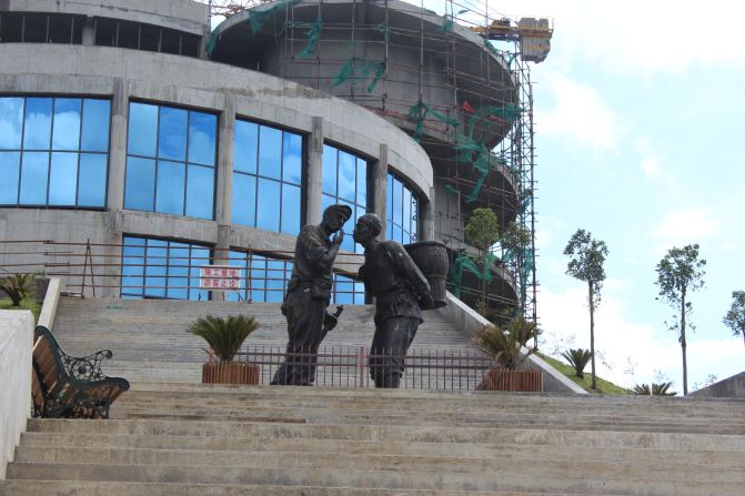
A visitor center was still under construction when I made the trip. Outside, stood a statue of a US soldier lighting the cigarette of a Chinese peasant – a tribute to another famous wartime photo.
The view from the mountain top is jaw dropping and it’s hard to imagine the fabled road being forgotten again.