


Story highlights
Hurricane Harvey is already considered a historic storm
Climate change can impact hurricanes' rainfall and storm surge
Before Hurricane Harvey even made landfall in Texas, many people were asking whether this churning storm in the Gulf of Mexico and its predicted impact were intensified by climate change.
Here’s a breakdown from experts.
‘One-in-1,000-years type of event’
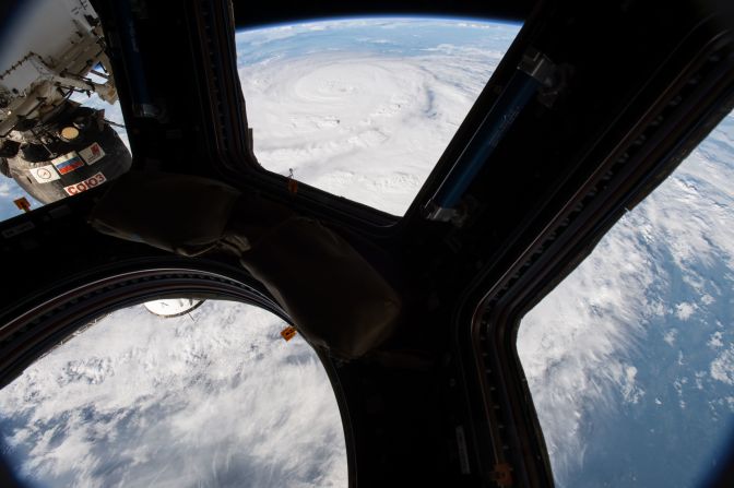
To understand how Harvey could be impacted by climate change, you have to understand how unique a storm it is. Harvey underwent “rapid intensification,” gaining strength very quickly. From Thursday morning into Friday afternoon, it transitioned from a tropical storm with winds of 45 miles per hour to a Category 3 major hurricane with winds of 125 miles per hour in only 36 hours.
Rapid intensification isn’t necessarily rare, but it is very hard to forecast. When all the conditions come together just right, a storm can really “blow up” and intensify very quickly.

Harvey was downgraded to a tropical storm over the weekend and expected to make a third landfall.
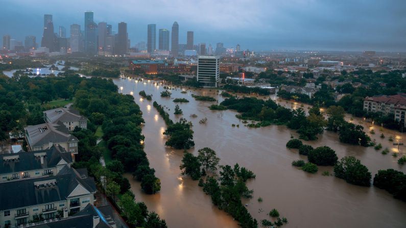
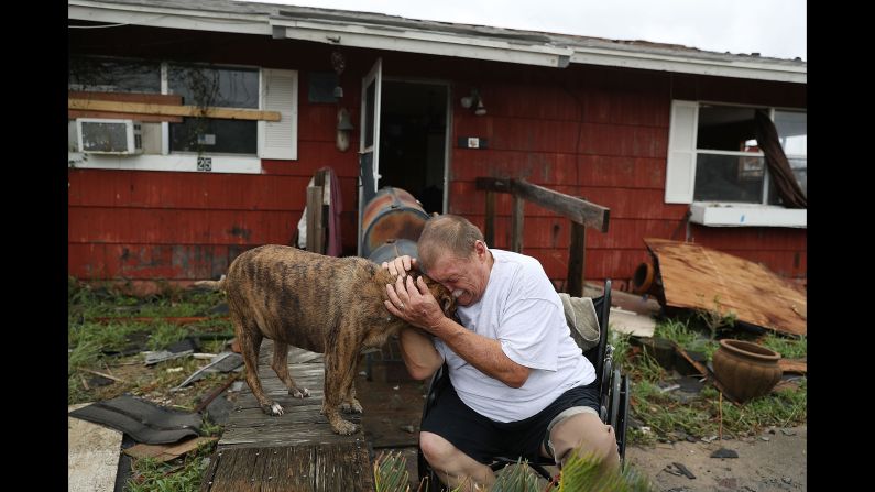
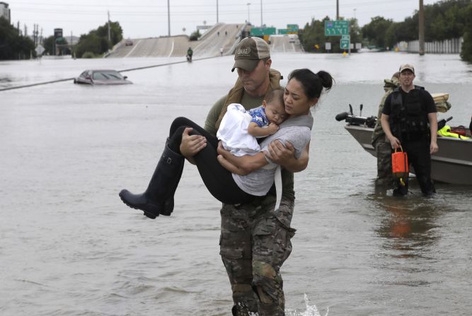
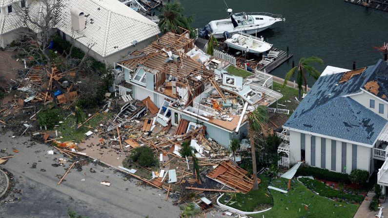
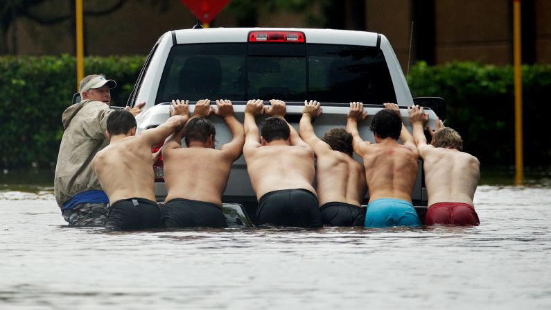
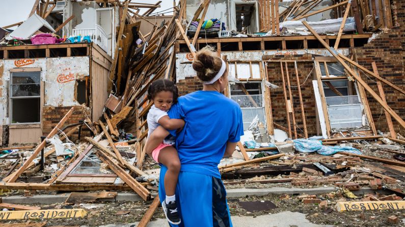
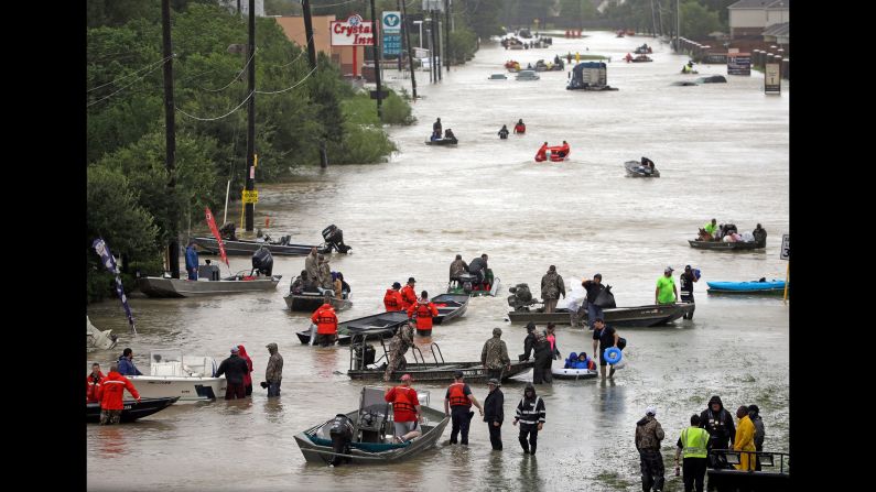
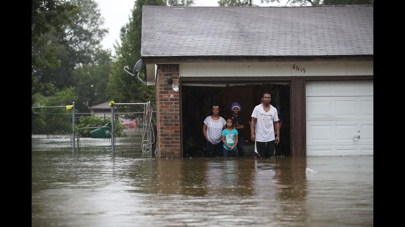
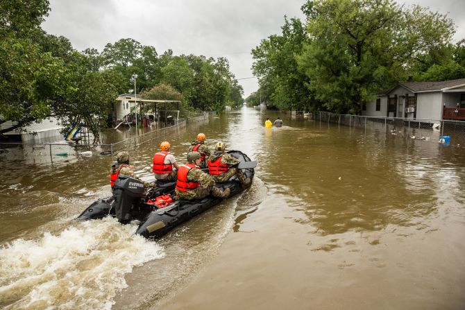
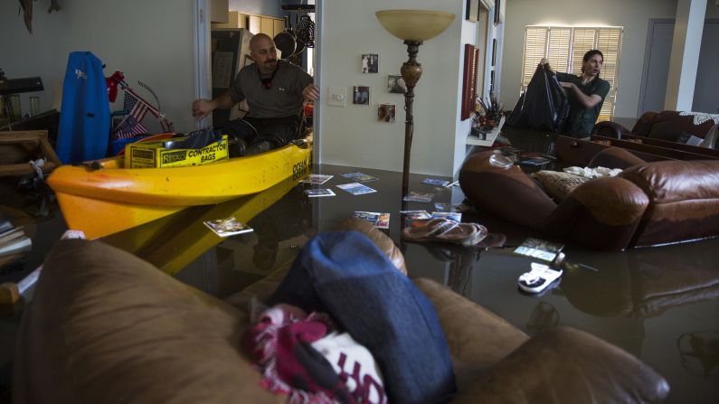
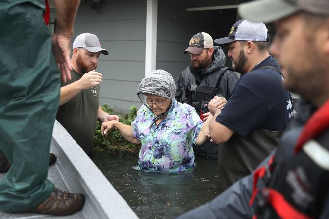
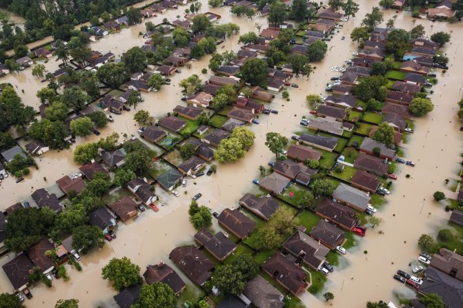
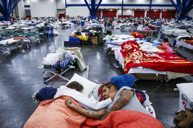
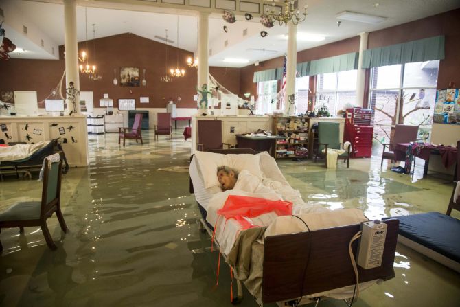
It is rare for a storm to move inland and then back out again over the same body of water it came from. Excessive rainfall has caused flooding more devastating than the impact of Harvey’s initial landfall itself.
Inland flooding is often one of the worst impacts for storms making landfall. With the stalling of the storm over land, the flood threat has become Harvey’s lasting impression.
CNN meteorologist Dave Hennen labeled Harvey a “one-in-1,000-years type of event.”
By amount of rainfall, Harvey might end up ranking No. 1.
Rising temperatures, rising oceans
Gradually warming temperatures in the Gulf of Mexico – as much as 2 degrees Celsius above average – could be a pressure cooker for key ingredients of a hurricane: extreme winds, rainfall and storm surge.
Where Harvey intensified and made landfall off the Texas/Mexico coast, the water temperatures were about 1 degree Celsius above average. The highest water temperatures were in the eastern Gulf, near Florida.
This warm area of the eastern Gulf is also where a tropical disturbance has been trying to form for the past week, but it never became a tropical depression. So although warmer water can be associated with strong hurricanes, that isn’t always the case.
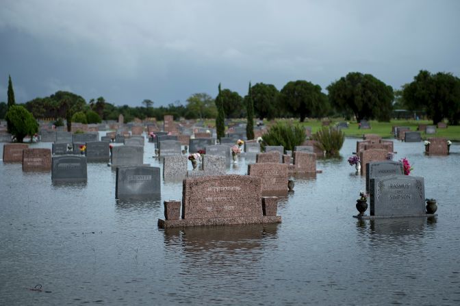
The most direct ways climate change influences hurricane landfalls can come in the form of increased storm surge as a result of sea level rise. The storm creating the surge might not be worse, but if it is occurring along a coast where sea levels are higher because of climate change, the storm surge itself will then be higher.
“The globally averaged sea level has risen about 7 inches in the last century largely due to the climate change effects of warming ocean water and glacial land ice melting and flowing into the oceans,” Sean Sublette, a meteorologist at the nonprofit Climate Central, wrote in an email. “This higher sea level means that storm surge or the coastal flooding that occurs when a hurricane makes landfall is higher and reaches farther inland.”
The other direct way climate change can influence hurricanes is through rainfall. More extreme precipitation is one of the calling cards of a warmer world, experts say.
“A warmer atmosphere can also hold more water,” Sublette wrote. “It’s the reason that it feels humid in the summer, but not the winter – there is more actual water vapor in the atmosphere. For every 1°F of warming, the atmosphere can hold 4% more water vapor. And the global atmosphere is about 1-3°F warmer than a century ago.”
This has been predicted with models and has been observed across the Southeast and specifically in Texas, according to John W. Nielsen-Gammon, professor of atmospheric sciences at Texas A&M University and the Texas state climatologist.
“The heaviest rainfall in Texas has been associated with landfalling tropical storms,” Nielsen-Gammon said. “In 1979, thunderstorms associated with Tropical Storm Claudette dropped 42 inches of rain in 24 hours just south of Houston. While most storms won’t be that exceptional, climate change is making even heavier rainfall possible.”
‘A huge disaster with or without warming’
Scientists will analyze the connections between Harvey and climate change using historical observations and computer simulations, but that won’t occur until the storm is over.
But they are already trying to answer questions about the storm and what caused it.
“Across the world and the United States – and in Houston specifically over the last couple of decades – heavy precipitation events have been increasing in frequency and intensity, as predicted by climate science,” Adam Sobel, a professor at Columbia University who researches atmospheric and climate dynamics, wrote in an email. “Given the specific meteorological situation (the positions of the high pressure systems and the jet stream), and the presence of a major city in the location it is, Harvey would have been a huge disaster with or without warming.”

“This does not mean Harvey would not have formed, nor does it mean that the flooding would not have occurred, but it does mean it was very likely made worse,” Sublette said of the climate change influence. “In the decades to come, climate change is expected to make the strongest hurricanes a bit stronger, but the overall number of hurricanes each year is not expected to dramatically change.”
Nielsen-Gammon is interested in the peak intensity limit of heavy rainfall for these events because they happen so rarely. If climate change can increase heavy rainfall in the future, it needs to be quantifiable for predictions.
“There is some infrastructure we don’t want to fail under any circumstances, such as large dams that need to withstand any conceivable flood, but we have to put a limit on what is conceivable, and with climate change, that is becoming more and more difficult.”