


Satellite images show just how high the water has risen along the Platte and Missouri Rivers, including a large portion of a US Air Force Base under water.
Upstream from Scribner, Nebraska, on the Elkhorn River, a flood gauge measured its second highest crest: 17.65 feet. The flood gauge just downstream from the town stopped reporting on Wednesday when minor flooding was taking place; it could have been affected by ice floes.
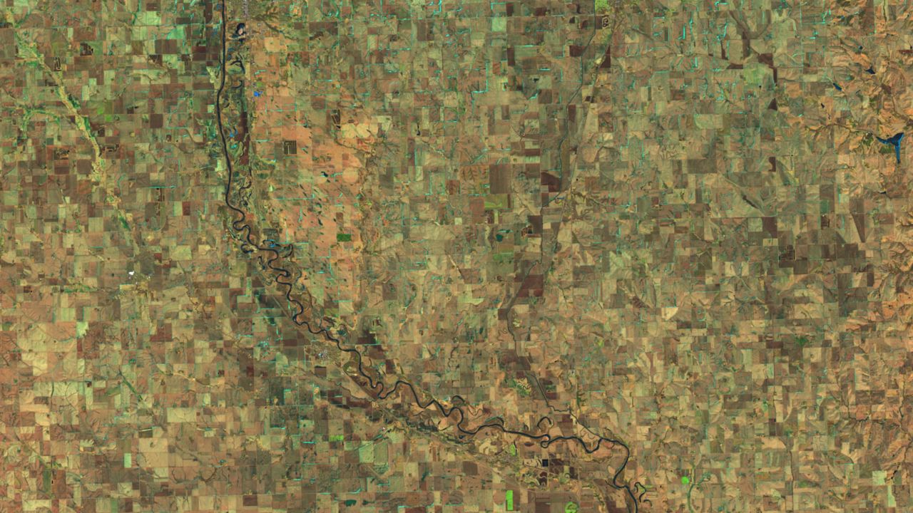
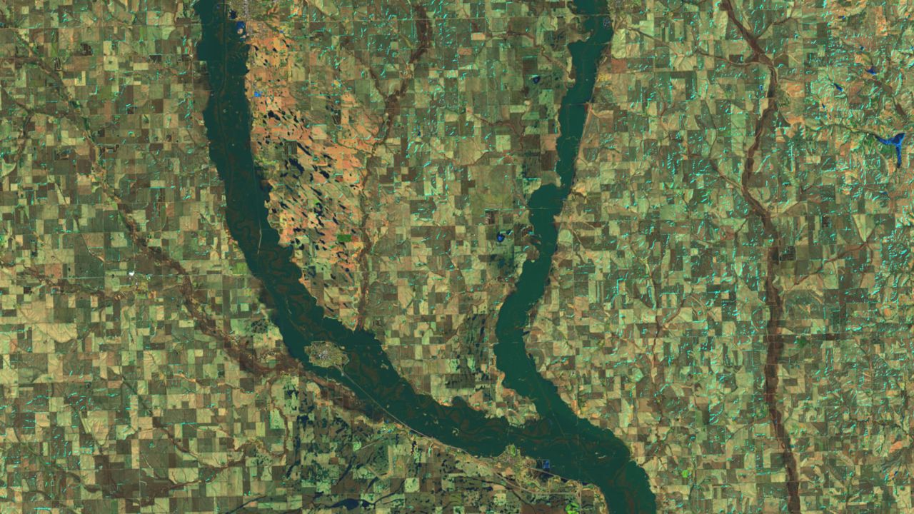
The images show how the Elkhorn River temporarily made the town of Scribner an island. It appears, looking at satellite imagery, the only connection for the almost 900 residents of the town was Highway 275.
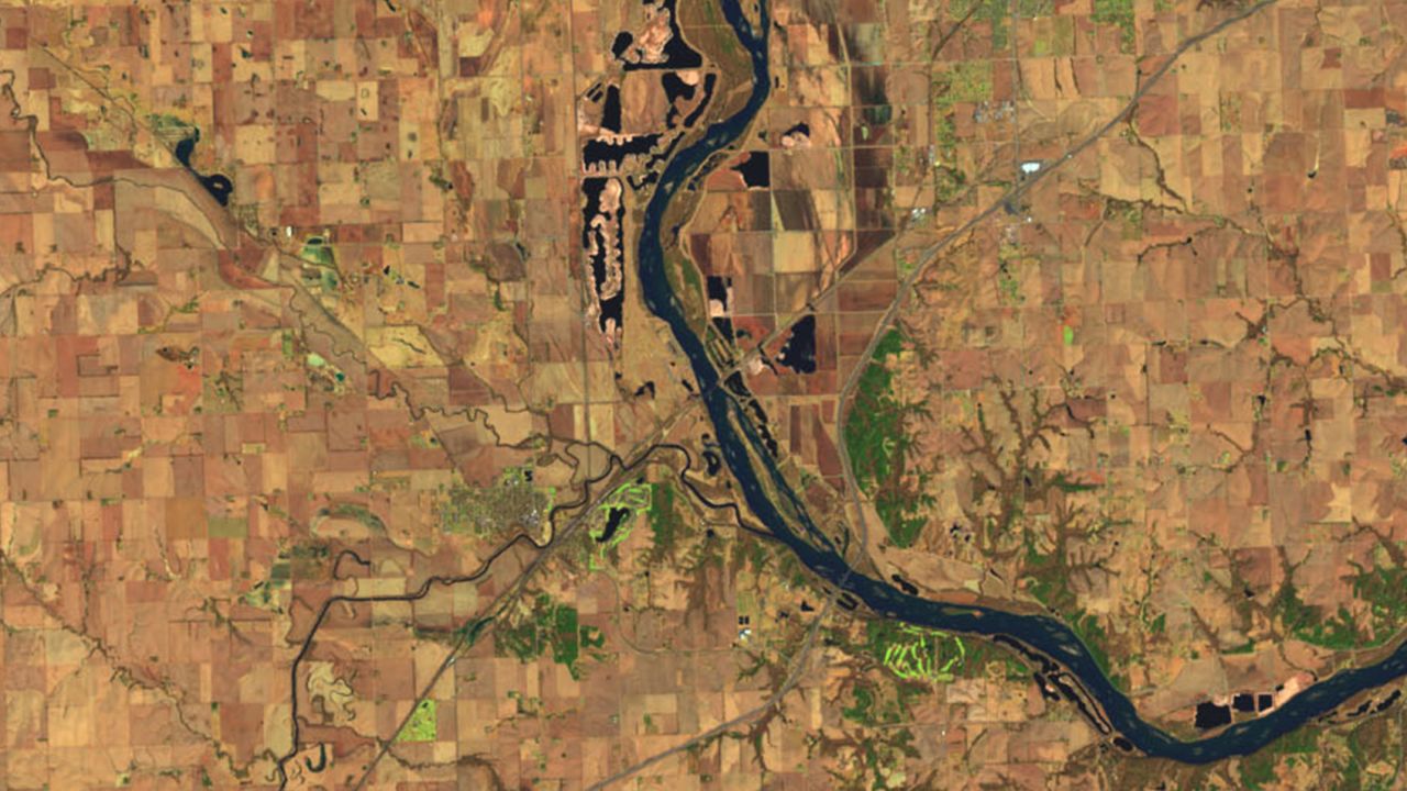
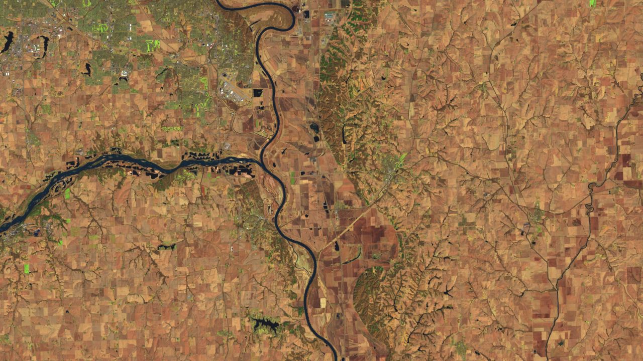
Normally, the Logan Creek Dredge, the river that flows into the Elkhorn River, is barely visible. It, too, far exceeds its usual banks.
Downstream in Waterloo, Nebraska, the Elkhorn River rose to 24.64 feet, the highest ever measured.
It beat the previous record, set in 1962, by more than 5 feet. The Platte River, to the left in the image, also was at historic levels farther upstream, in Leshara, Nebraska.
How much water was flowing in the Platte River is apparent by how far it exceeds its banks between North Bend and Fremont, Nebraska.
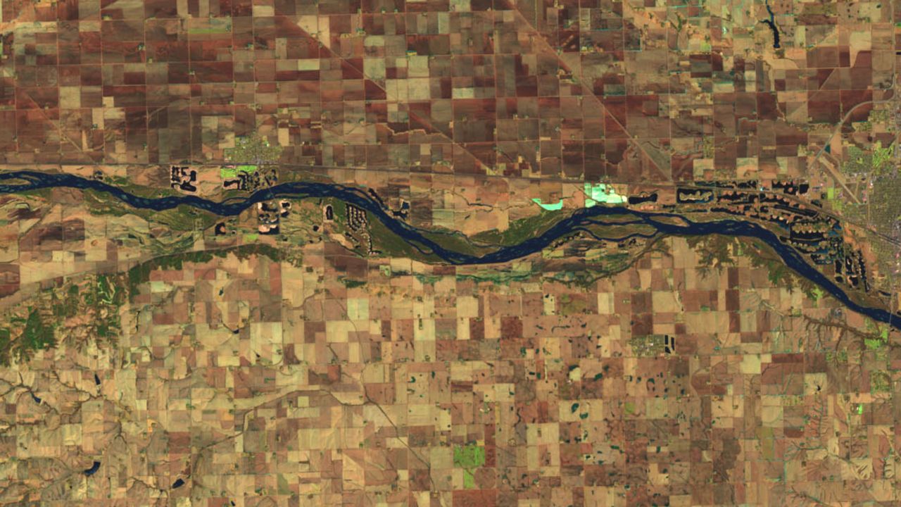
The 28,000 residents of Fremont were cut off during the height of the flooding. While no injuries were reported, authorities were conducting rescue missions across the city.
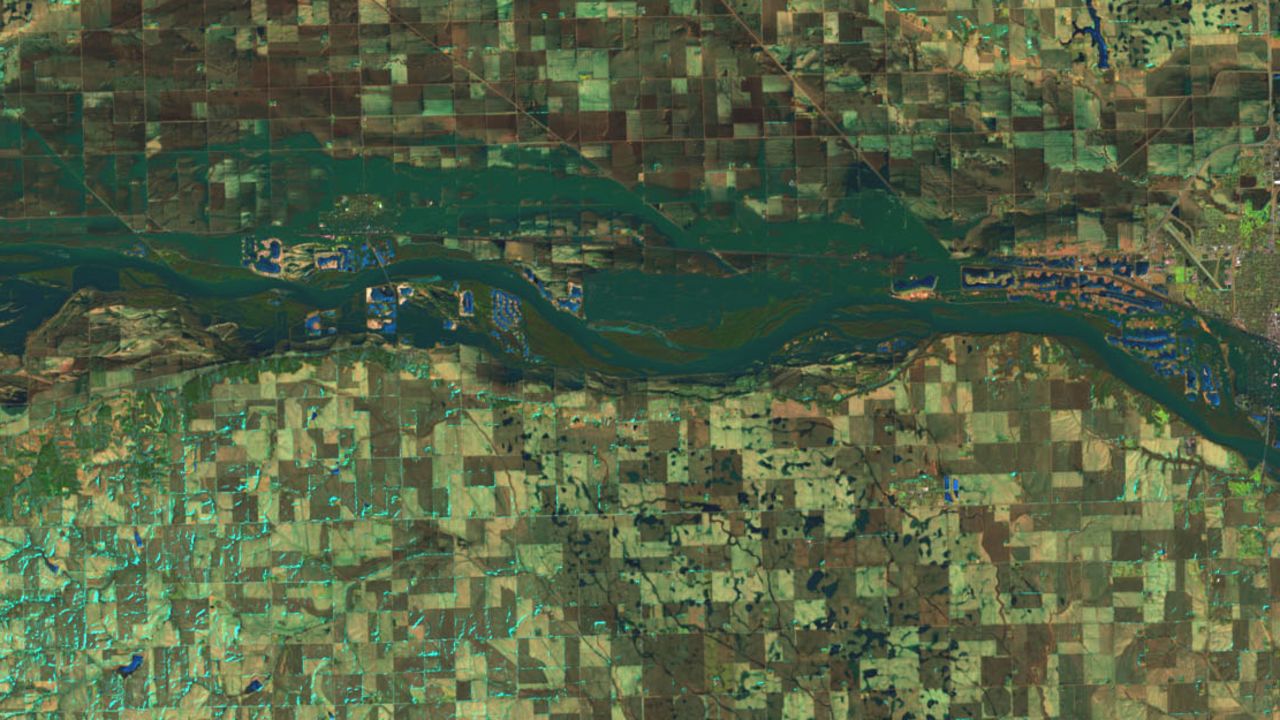
In Ashland, Nebraska, the Platte River also saw record levels of flooding. The river there — 24.35 feet on Saturday — was over a foot higher than ever recorded.
The river swelled so much there, it cut through swathes of farmland, turning the highest points into islands.
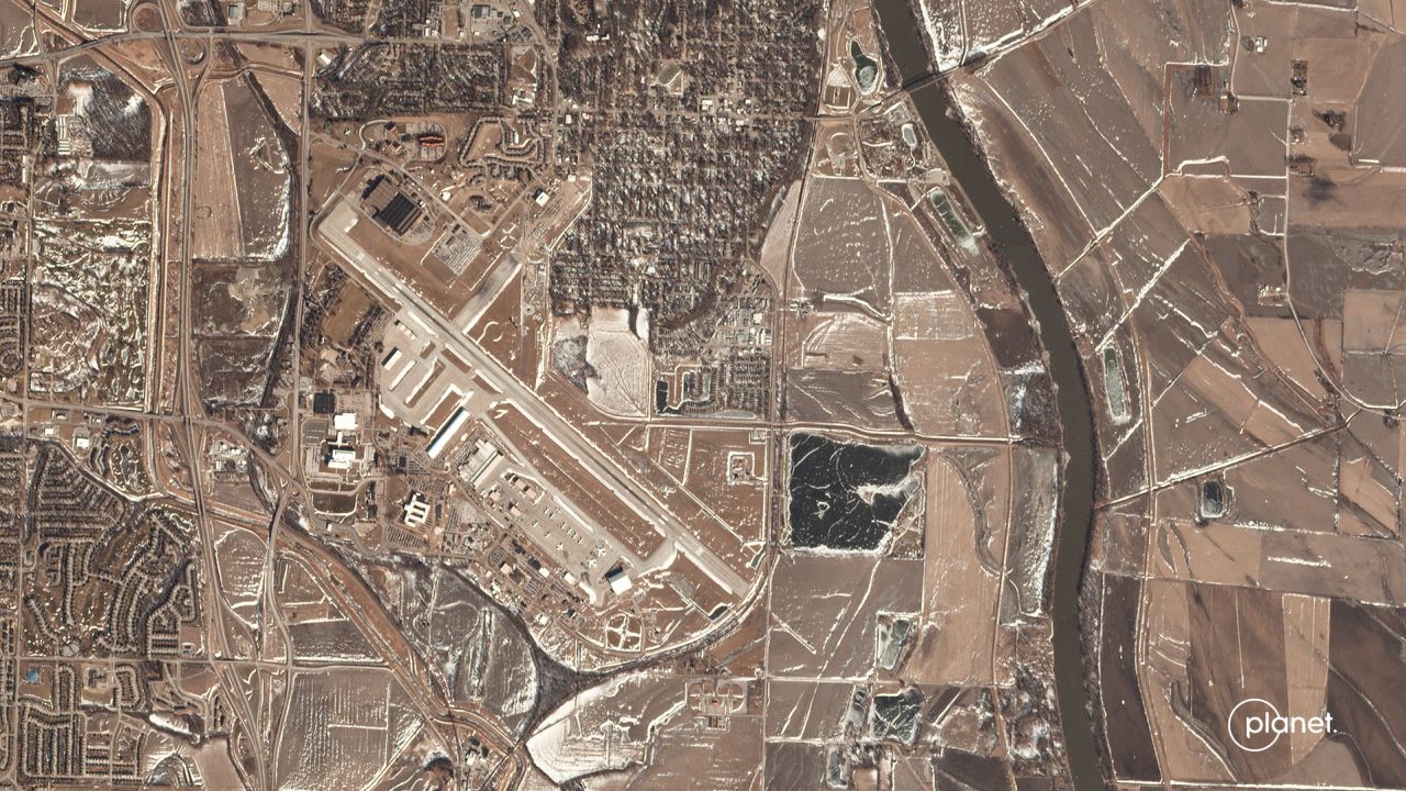
Offutt Air Force Base sits along the Missouri River just south of Omaha, Nebarska. Satellite imagery from Planet Labs Inc. shows much of the base sitting in Missouri River floodwaters.
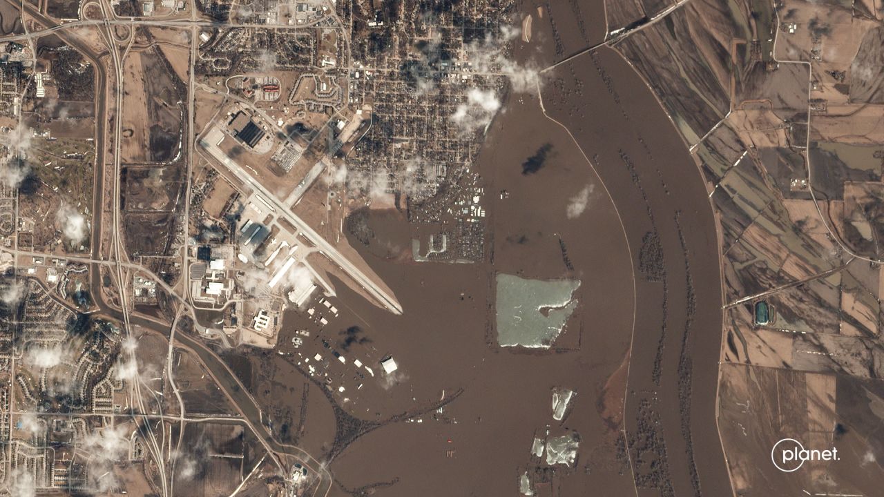
Floodwaters made it into some 30 buildings on base and nine aircraft were evacuated because of the flooding, officials said. They included eight variations of a C135, and one E4B, an advanced airborne command post known as a “doomsday plane.”
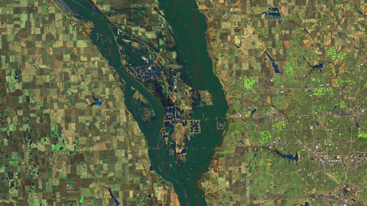
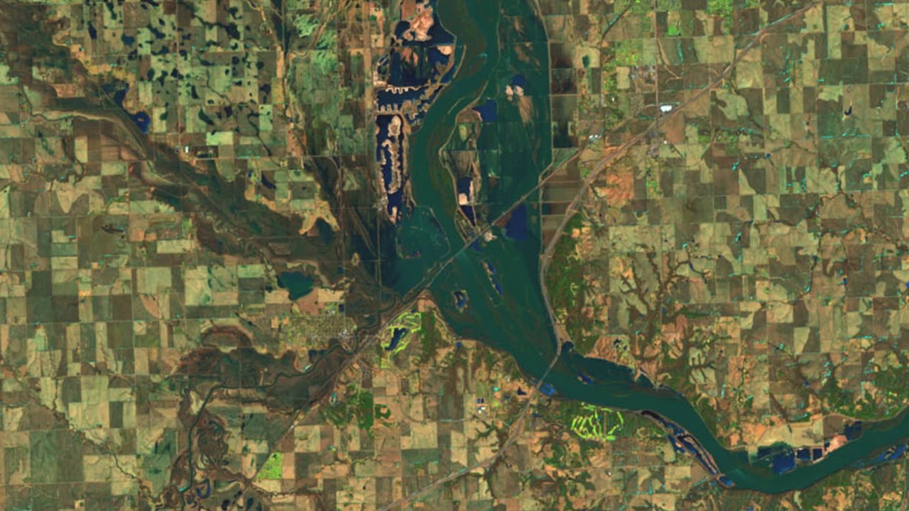
One of the most dramatic images shows the mouth of the Platte River where it meets the Missouri River near La Platte, Nebraska.
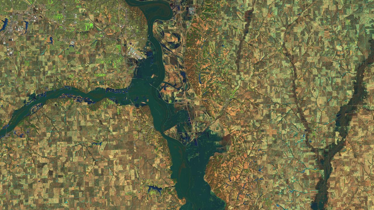
The Sarpy County Sheriff’s Office said it’s still not safe enough to allow residents of the Hanson and Chris Lakes area back into their homes. A flood gauge just downstream on the Missouri River pegged its level at 40.62 feet on Saturday, over 4 feet above the historic crest.