Hurricane Ida makes landfall in Louisiana

By Fernando Alfonso III, Mike Hayes, Judson Jones, Adrienne Vogt, Meg Wagner, Aditi Sangal, Kathryn Snowdon and Jack Guy, CNN

Updated 8:22 a.m. ET, August 30, 2021
39 Posts
Sort byDropdown arrow
3:07 p.m. ET, August 29, 2021

Hurricane Ida shuts down 95% of Gulf of Mexico's oil production

From CNN’s Matt Egan

The Royal Dutch Shell Plc Convent Refinery is seen ahead of Hurricane Ida, on Saturday, August 28 in Convent, Louisiana.
The Royal Dutch Shell Plc Convent Refinery is seen ahead of Hurricane Ida, on Saturday, August 28 in Convent, Louisiana. Luke Sharrett/Bloomberg/Getty Images

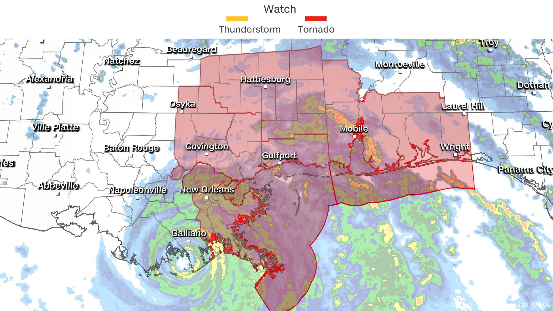
More than 95% of the Gulf of Mexico’s oil production has been shut down thanks to Hurricane Ida, regulators said Sunday, indicating the hurricane is having a significant impact on energy supply.  

As of 11:30 a.m. CT, personnel have been evacuated from a total of 288 oil-and-gas production platforms, according to the Bureau of Safety and Environmental Enforcement. That represents about 51% of the manned platforms in the Gulf of Mexico.

The agency said all 11 rigs in the Gulf of Mexico have also been evacuated, and a total of 1.7 million barrels of daily oil production in the Gulf of Mexico has been shut-in – the equivalent to 95.7% of the region’s total output. 

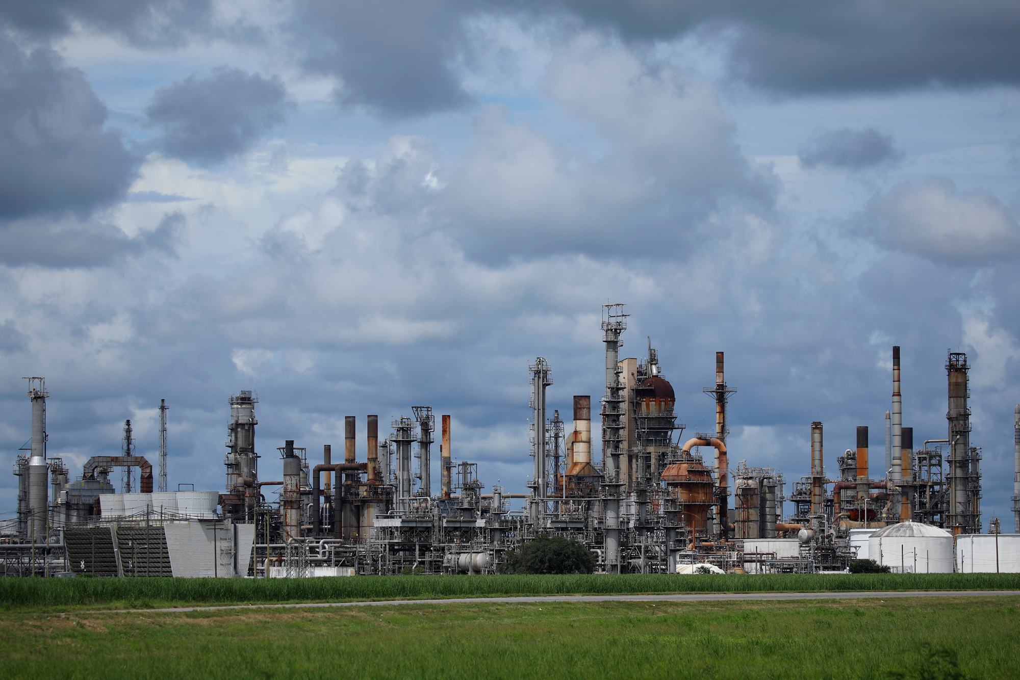
The widespread loss of oil supply from one of America’s energy hubs is likely to lift prices.  US oil prices rose sharply last week ahead of Hurricane Ida’s arrival. 

Oil futures are set to begin trading at 5 p.m. ET on Sunday.

3:05 p.m. ET, August 29, 2021

More than 200,000 customers are without power as Ida moves through Louisiana

From CNN’s Rebekah Riess

Entergy Corp. electric utility company bucket trucks are staged on Canal Street in New Orleans on Sunday, August 29, during Hurricane Ida.
Entergy Corp. electric utility company bucket trucks are staged on Canal Street in New Orleans on Sunday, August 29, during Hurricane Ida. Patrick T. Fallon/AFP/Getty Images

There are now more than 200,000 customers without power in Louisiana as Hurricane Ida maneuvers inland.

According to poweroutage.us, 223,680 customers are without power as a result of Hurricane Ida, an increase of more than 73,000 in around 30 minutes. There were 150,012 customers without power at 1:54 p.m. ET.

Power outages are expected to continue as the storm moves inland.

2:43 p.m. ET, August 29, 2021

Extreme wind warning west of New Orleans

From CNN's Jackson Dill

A new extreme wind warning is in effect for locations further inland than the previous warning, which just expired, due to Hurricane Ida.

This new warning is in effect until 4:30 p.m. CDT and spans from the coast through the southwestern corner of Lake Pontchartrain, including Houma, Laplace and Bayou Cane in Louisiana.

“Widespread destructive winds of 115 to 135 mph will spread across St. John The Baptist, St. James, St. Charles, Terrebonne, Lafourche, Jefferson, Plaquemines and Assumption Parishes, producing swaths of tornado-like damage,” the National Weather Service in New Orleans warned.

People have been asked to seek shelter over the next few hours as the NWS warns that it’s “an extremely dangerous and life-threatening situation!”

More than 300,000 people normally reside in the area of this warning.


3:25 p.m. ET, August 29, 2021

Hurricane Ida storm surge and winds have partially reversed flow of Mississippi River near New Orleans

From CNN’s Brandon Miller and Paul P. Murphy

Data from the US Geological Survey (USGS) indicates that the flow of the Mississippi River in New Orleans has partially reversed its flow due to the strong storm surge and winds from Hurricane Ida pushing up the river. 

The river gauge at Belle Chasse, just southeast of central New Orleans, shows the surface velocity of the water slowing significantly on Sunday morning from 2 feet per second down to zero by 10 a.m. CDT.

The flow rate has been negative for the past three hours, reaching a peak of -0.21 feet per second at 12:45 p.m CDT.


2:38 p.m. ET, August 29, 2021

Man says he's riding out Hurricane Ida on a boat

From CNN's Adrienne Vogt

Josh Welch is riding out Hurricane Ida on a boat in Grand Isle, Louisiana.

"A lot of wind and rain right now. I mean, you can't even see the dock or nothing. It used to be a dock over, I guess, but it ain't no more," he told CNN. "It's pretty bad right now."

Welch said four men are on the boat with him.

"We realized we was trapped" by the time conditions deteriorated, he said.

He said his cell phone is in and out of service and he's "shocked" the cell tower is still up.

Welch said this is the first time he's ever experienced anything like this. He's seen other hurricanes, but "this is the first time I've actually been in one." 

Watch the interview:

2:16 p.m. ET, August 29, 2021

New Orleans EMS suspends operations as Ida continues moving inland

From CNN’s Gregory Lemos

New Orleans Emergency Management Services said Sunday it has suspended all operations as Hurricane Ida makes landfall.

“NOEMS operations have been suspended due to dangerous winds,” the department said in a tweet Sunday.

NOEMS said operations will resume once conditions are safe for first-responders.

2:13 p.m. ET, August 29, 2021

Tornado watches issued within storm

Tornadoes may spin up now that Hurricane Ida is moving ashore. A tornado watch is in effect for portions of Louisiana, Mississippi, Alabama and Florida. The threat of a few tornadoes will increase throughout the day and into the evening. 

"Hurricanes and tropical storms that make landfall in the Gulf of Mexico are more likely to produce tornadoes compared to storms in the Atlantic," explains Brandon Miller, CNN meteorologist.

It is important to note because the threat of tornadoes is not limited to the coastline or to the day of landfall. 

Often, the day after landfall can produce more tornadoes than on the landfall day itself, and they can occur hundreds of miles inland.

Know the difference between a watch and a warning.

2:05 p.m. ET, August 29, 2021

Here's what Hurricane Ida looks like from space

International Space Station crew member Thomas Pesquet captured a photo of Hurricane Ida from space just a few hours before it made landfall in Lousiana.

"Observing hurricanes from space helps us work with partner agencies like @NOAA and @FEMA to support preparation and disaster response," NASA tweeted along with the image.

See the tweet:

1:45 p.m. ET, August 29, 2021

Hurricane Ida tied for strongest storm to ever hit Louisiana

From CNN's Brandon Miller

With Hurricane Ida making landfall as a 150 mph Category 4 hurricane, it is now tied for the strongest storm to ever make landfall in Louisiana. 

By the numbers:

  • Hurricane Ida ties Laura (2020) and the Last Island Hurricane in 1856 as the strongest to hit LA (all had 150 mph top winds).
  • Louisiana becomes the first US state to record a 150+ mph hurricanes in back-to-back years (Laura and Ida)
  • A 150 mph Category 4 hurricane has more than 250 times the damage potential of a 75 mph Category 1 storm, per NOAA analyses
  • Hurricane Ida’s hurricane-force winds extend 50 miles from the center, and tropical storm-force winds stretch 150 miles from center. The center is forecast to pass about 30 miles west of New Orleans.
  • New Orleans has received over 65 inches so far this year, their second wettest on record to this point of the year. This will make flooding in the region worse. New Orleans is expecting 15-20 inches of rain with Ida.