
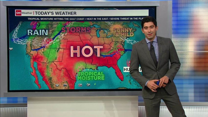
Tropical Storm Imelda weakened to a tropical depression but could still shower the Houston area with the most rainfall it has seen from one storm since Hurricane Harvey as early as Wednesday, raising prospects of heavy flooding in a city that sees plenty of it.
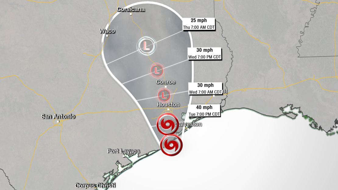
Imelda formed over the Gulf of Mexico on Tuesday afternoon and made landfall near Freeport, the National Hurricane Center said. The storm was dumping rain over southeastern Texas and is expected to keep doing so for a couple of days as it moves inland.
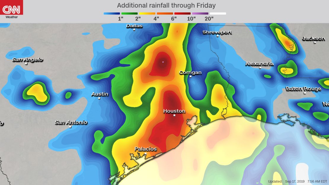
“Many of the forecast models are suggesting 6 to 10 inches of rain with isolated higher amounts across the region,” CNN meteorologist Judson Jones said. “If the forecast holds, the amount of rain to fall would be the highest storm total rainfall since Hurricane Harvey in 2017.”
Imelda had maximum sustained winds of 40 mph Tuesday evening, the NHC said in an advisory. A tropical storm warning was in effect for along the Texas coast from Sargent to Port Bolivar, the center said.
Also, a flash flood watch covering more than 7 million people and including Houston and Galveston was in effect and likely to be extended into Thursday.
“Rain will be in the area over the next several days and could cause some flooding. Be careful driving and please pay attention to the weather reports,” Houston Mayor Sylvester Turner said in a post on Twitter. “Be alert.!”
Several schools and universities in the Houston and Galveston area announced they will cancel activities Wednesday. Among them were the Galveston Independent School District, Houston Independent School District and Texas A&M University at Galveston.
Even before Imelda became a tropical storm, it was a system that was raining on coastal Texas. By Tuesday evening, as much as 5 inches of rain had fallen in some areas southeast of Houston, according to the Harris County Flood Warning System. Most areas of Houston saw a 1/2 inch to 1 inch of rain.
The storm system is expected to drench coastal Texas and southwestern Louisiana into Wednesday, and eastern Texas and western Louisiana on Thursday, the hurricane center said.
Flooding problems in Houston
Harvey deluged the Houston area for days in late August 2017, causing disastrous flooding, claiming dozens of lives and causing billions of dollars in damage.
During that storm, more than 34 inches of rain were recorded at Houston’s George Bush Intercontinental Airport, and more than 40 inches of rain were recorded in areas east of the city.

Houston is no stranger to flooding. In May, for instance, heavy rain led to significant flooding in streets, homes and businesses.
The city’s layout and city planning are part of what makes its flooding problem worse, experts have said.
Urban sprawl over past decades has turned water-absorbing greenery into concrete. Weak regulations have failed to properly estimate the potential hazards of flooding. Finally, poor reservoir and land management have revealed a lack of long-term planning on these issues, the experts have said.
Another storm brewing
Tropical Depression 10 is brewing in the Atlantic Ocean and is expected to become a Tropical Storm Jerry by Wednesday. The storm could become a hurricane by the end of the week as it passes near or just north of the Lesser Antilles, CNN Meteorologist Taylor Ward said.
CNN’s Pierre Meilhan, Dave Hennen, Eric Levenson and Taylor Ward contributed to this report.