


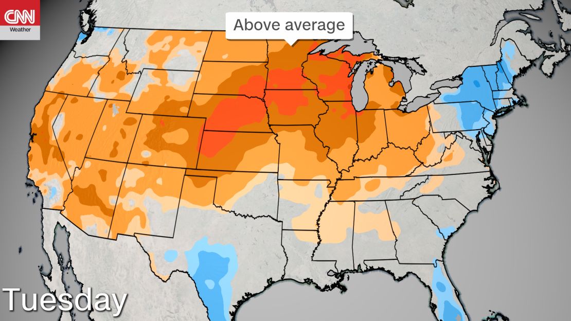
Near-record heat is searing the central United States, including major cities such as the Minneapolis-St. Paul area, which will also see severe storms Tuesday.
“Tuesday looks to have active weather for the metro Minneapolis-St. Paul region, which could have impacts on the ongoing protests,” CNN meteorologist Brandon Miller said.
Monday was the hottest day of the year so far in Minneapolis-St. Paul with a high temperature of 91 degrees recorded and Tuesday could be even hotter.
Check the forecast from CNN’s team of meteorologists >>>
“Temperatures will climb into the 90s for the first time and could reach the record high of 93 Fahrenheit on Tuesday,” says Miller.
These warmer temperatures could present a heat stress threat to protesters and police in the afternoon and early evening.
The heat will help kick off some scattered thunderstorms in the afternoon Tuesday, some of which could be severe, said Miller.
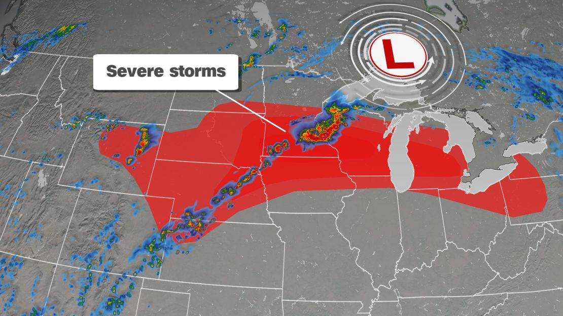
These storms could come anytime in the afternoon through the evening. They could bring lightning, strong winds, large hail and even tornadoes.
Omaha, Nebraska; Des Moines, Iowa; and Milwaukee could also see intense storms develop Tuesday afternoon and evening.