


After a mild end to the weekend for many states, Old Man Winter will make a comeback as we start off the new workweek.
“Temperatures will be 10 to 20 degrees below average over the northern tier states by Monday morning,” the Weather Prediction Center said Saturday.
And that’s just the beginning. The thermometer will slip to 30 to 40 degrees below normal by Tuesday and Wednesday, as a strong high pressure system begins to spread Arctic air farther south and east.
Some people voluntarily choose to do a polar plunge, as seen here. This week, many will experience plunging temperatures whether they like it or not.
Many cities will see a sharp polar plunge in a 48-hour span.
Denver will go from a high temperature in the low 60s Sunday all the way down to 15 for the peak Tuesday, with snow showers.
Rapid City, South Dakota, will slide from a high of 50 degrees Sunday to 0 degrees for a high Tuesday. By Tuesday night, the bottom will drop out in the Black Hills to 15 degrees below zero.
Some cities will see the drastic drop in temps even more quickly, in a mere 24 hours.
In Amarillo, TX the high temperature Monday will top out in the low 70s, but quickly drop to the mid 30s just one day later.
Wichita, KS will plummet even further, going from a high near 70 Monday down to the mid-20s for a high Tuesday.
Over the next week more than 70% of Americans in the Lower 48 will experience temperatures below the freezing mark. More than 15 million will endure temperatures below zero.
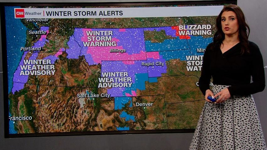
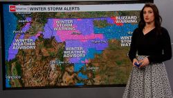
With such cold temperatures already in place, any moisture moving through will result in snow spreading across a wide region.
“Arctic front arrives late Sunday bringing snow, bitter cold, [and] hazardous travel,” the National Weather Service (NWS) office in Rapid City, SD said. They also strongly advised wearing layers, and carrying a winter survival kit if you are traveling.
Frigid cold meets prolonged snow
The snow will begin across the Upper Midwest, but since the cold front will not move very quickly, it will allow for considerable snowfall rates across the area.

“A long period of snow and gusty northeast winds will begin late Sun night and continue thru Tuesday,” the NWS office in Twin Cities, MN said in a tweet. “Snow may be heavy at times with significant accumulations across parts of the Upper Midwest.”
By Tuesday, sleet, rain and freezing rain will cover the Great Lakes region, where significant ice accumulations are possible.
Approximately 6 inches of snow is forecast across portions of the northern Plains and Midwest through Tuesday, but some areas could see upwards of 12 inches.
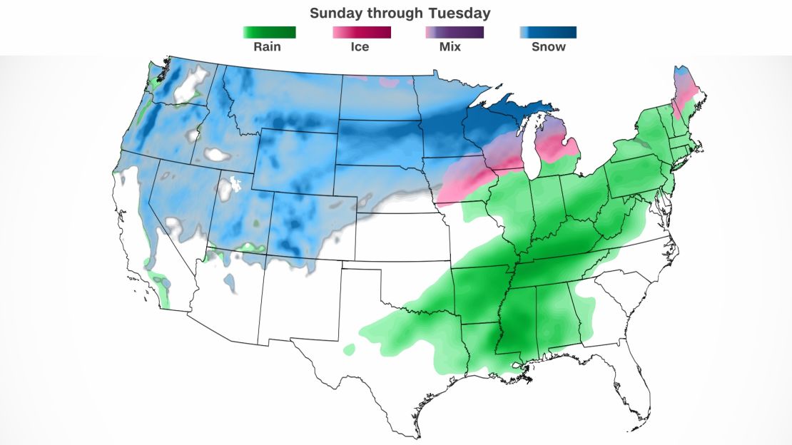
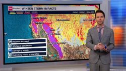
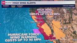
The slow movement of the system will also be a concern on the southern side of the storm due to very heavy rain.
“Confidence is increasing that a multiday rainfall event will bring concerns of flooding,” the NWS office in Nashville said.
The bulk of the rain will fall in the Southeast Monday and Tuesday.
The South will be one of the few areas dealing with above average temperatures Monday, which will help fuel severe storms.
The Ark-La-Tex region as well as the lower and mid-Mississippi Valley will see possible tornadoes, large hail and wind damage from Monday afternoon into Monday night.
You can track the storm here as it develops this week.
CNN Meteorologist Haley Brink contributed to this story