The second-largest man-made reservoir in the country has dropped to unthinkable lows amid the West’s climate change-driven megadrought.
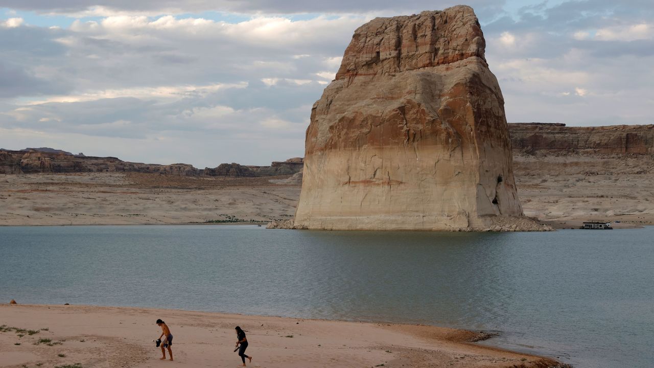
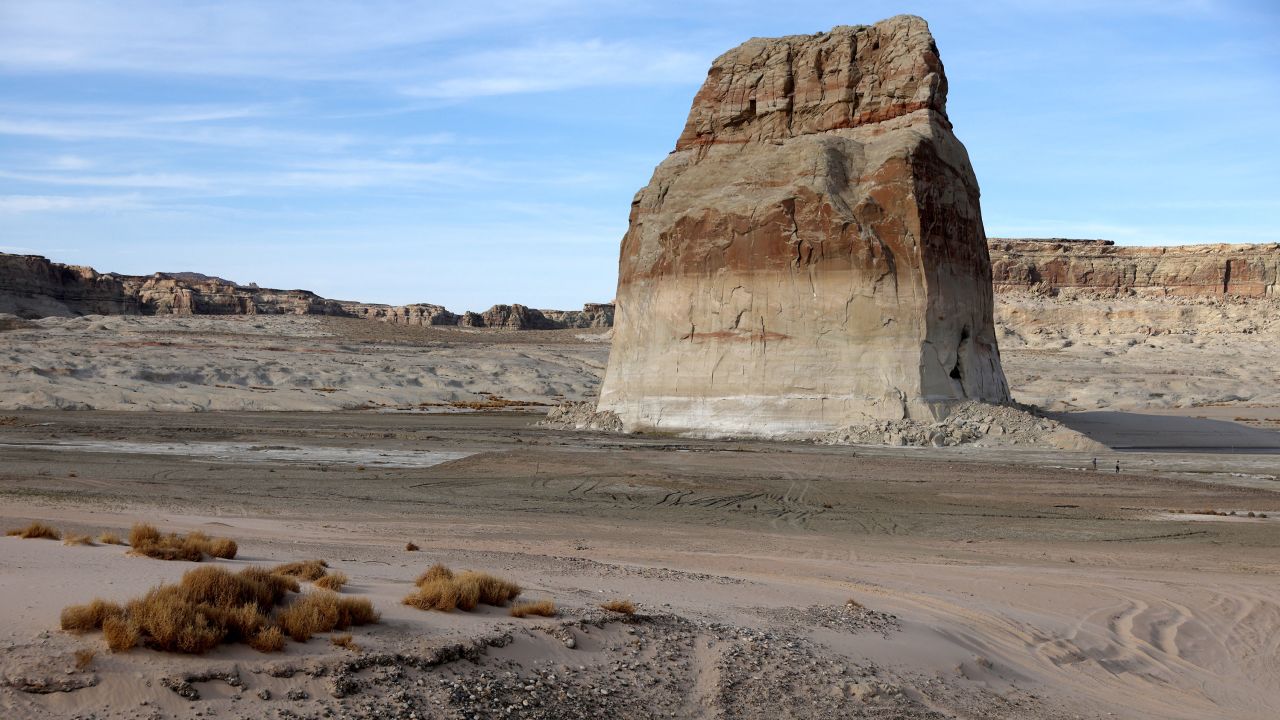
A pair of before and after photos at Lake Powell illustrates how alarming the transformation has been. The “before” was taken June 23, 2021, and the “after” was taken Sunday. In the first image, countless waves ripple across the landscape and the lake surrounds the massive Lone Rock; in the second – from the same vantage point – the ground sits parched, nary a puddle to be seen.
At around 24% full, Lake Powell is at its lowest level since 1963, when the Glen Canyon Dam was built and the reservoir – near the Utah-Arizona border – was filled.
Water flowing down the Colorado River fills Lake Powell and Lake Mead – another critical reservoir in the West – and the river system supports more than 40 million people living across seven Western states and Mexico.
Both reservoirs provide a critical supply of drinking water and irrigation for many communities across the region, including rural farms, ranches and native communities.
This month, Lake Powell’s water level dropped below a key threshold under which the water shortage situation becomes dire. Much below this level, the Glen Canyon Dam risks no longer being able to generate hydropower at the Glen Canyon Powerplant.
There’s a 1 in 3 chance Lake Powell’s level will be too low in 2023 for the plant to generate electricity, according to a US Bureau of Reclamation report released in September. At full capacity, the dam produces power for around 5.8 million homes and businesses from Nebraska to Nevada.
The West’s megadrought is the worst in centuries, scientists have found. The period from 2000 to 2021 was the driest in 1,200 years, according to a study published in February.
The human-caused climate crisis has made it 72% worse, the study noted.