Hurricane Ida makes landfall in Louisiana

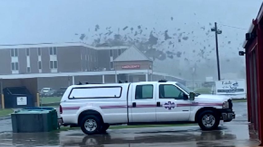
roof ripped off acosta vpx screengrab
Clinic's roof ripped off by winds from Hurricane Ida
00:40 - Source: CNN

What we covered

  • The latest: Ida weakens to a tropical storm with life-threatening flash flooding continuing Monday.
  • Overnight: At least one person is dead and nearly half the state of Louisiana is without power including the entire city of New Orleans.
  • Track the storm: You can follow Ida’s path here.
  • Are you in Ida’s path? Bookmark CNN’s lite site for fast connectivity. 

Our live coverage has moved. Follow here for live updates.

102 Posts

Our live coverage has moved

Our live coverage has moved. Follow here for the latest forecasts and live updates on the storm’s path and impact.

Ida weakens to a tropical storm with life-threatening flash flooding continuing Monday

Ida has weakened to a tropical storm with sustained winds of 60 mph.

The primary hazard throughout Monday will be life-threatening flash flooding, but dangerous storm surges, damaging winds and tornadoes continue to be threats. 

The storm surge warning has been discontinued from Morgan City to Grand Isle, Louisiana. The hurricane and tropical storm warnings have been discontinued west of Grand Isle, Louisiana. 

All remaining areas under a hurricane warning have been replaced with a tropical storm warning and stretch from Grand Isle to the mouth of the Pearl River. 

This includes Lake Pontchartrain, Lake Maurepas and the New Orleans metro.

Tennessee Emergency Management asks residents to prepare for Hurricane Ida impacts

The Tennessee Emergency Management Agency (TEMA) on Sunday advised residents across the state to prepare for possible impacts from Hurricane Ida.

“Hurricane Ida’s remnants may reach the west and middle portions of Tennessee on Monday evening through Tuesday with heavy rain and flash flooding possible over the same areas as last weekend’s flood emergency. The SEOC is monitoring the situation and preparing if response operations are needed,” TEMA said in a news release.

TEMA asked for residents to prepare now before Ida arrives.

PREPARE NOW

Prepare now before Hurricane Ida impacts Tennessee:

  • Know the flooding risk for your area.
  • Have a plan in place if Flash Flood warnings are issued and you need to evacuate.
  • Have multiple ways to receive weather information and updates.
  • Download the ReadyTN app, or any app providing weather updates to your smartphone.
  • NOAA weather radios can provide alerts and warnings for your area and can operate on batteries.

New Orleans residents may experience difficulties reaching 911

The New Orleans 911 service is currently experiencing technical difficulties, according to the Emergency Communications Center for the City of New Orleans.

“If you find yourself in an emergency, please go to your nearest fire station or approach your nearest officer. We will update you once this issue has been resolved,” the center said early Monday in a tweet.

New Orleans has lost power after Hurricane Ida slammed the area.

“This is the time to continue to remain in your safe places. It isn’t a time to venture out!! We will get through this together!” Mayor LaToya Cantrell said in a tweet.

Power outages extend to Mississippi

Significant power outages continue in Louisiana due to Hurricane Ida – while in neighboring Mississippi, 71,894 customers are in the dark, according to PowerOutage.US.

Overall, there are 1,082,955 customers in both states without power.

Phone lines down at Emergency Operations Center in St. Charles Parish, Louisiana

The phone lines at the Emergency Operations Center (EOC) in St. Charles Parish are currently down due to Hurricane Ida, according to an alert sent to parish residents and posted on the St. Charles Parish Facebook account.

“Our normal EOC phone lines are down due to Hurricane Ida. In the event of an emergency, please call 911. If you need to report something to the EOC or Public Works please email help@stcharlesgov.net,” the the alert said.

In an earlier parish Facebook post, residents were cautioned to stay inside their homes.

“While the most significant impacts of Hurricane Ida have passed, all residents are advised to remain in their homes while we assess damages and clear roads,” the post said.

“We are working in conjunction with St. Charles Parish Sheriff’s Office and Fire Services to clear roads from dangerous downed power lines, trees and damaged infrastructure such as water lines, gas lines and sewerage systems.”

American and United cancel outbound flights from Jackson, Mississippi international airport

American Airlines and United Airlines have canceled outbound flights from Jackson-Medgar Wiley Evers International Airport on Monday, the facility announced via Twitter.

American expects to resume departing flights on Tuesday, the airport added.

Dozens of patients to be moved after Louisiana health centers damaged

Roof and water leaks at some Ochsner Health System facilities in Louisiana mean dozens of patients will have to be relocated, officials said.

Ochsner Health Chief Operating Officer Mike Hulefeld said all 21 patients in St. Anne Hospital in Raceland would be removed, as well as 45 patients at the Chabert Medical Center in Houma.  

 “We will have to move some patients sometime early tomorrow morning, late tonight or early tomorrow morning, probably 3, 4 or 5 o’clock tomorrow morning,” Ochsner Health President and CEO Warner Thomas said.

With the ongoing power outage in New Orleans, the Ochsner Medical Center on Jefferson Highway is now using well water, Thomas added.

"I've never seen water like this in my life," Jean Lafitte mayor says

The Louisiana town of Jean Lafitte has been “totally devastated” by Hurricane Ida, with rescuers unable to reach hundreds of stranded residents after a vehicle wiped out a bridge, Mayor Tim Kerner Jr. told CNN.

Kerner said the majority of the community of 1,500 people, on Bayou Barataria in Jefferson Parish, about 30 miles south of New Orleans, had been evacuated. But “we have about 300 people, 200 people still there,” he added.

“We’ve suffered flooding before. We suffered storms before. But I’ve never seen water like this in my life. It just hit us in the worst way possible and it was such a massive storm that it just totally devastated us,” Kerner said.

More than 1 million customers are without power in Louisiana

More than 1 million customers in Louisiana are without power, according to monitoring site PowerOutage.US.

As of 12:47 a.m. ET, power outages had hit 1,006,861 customers in the wake of Hurricane Ida.

In neighboring Mississippi, 48,515 customers are without power.

Now a Category 1 hurricane, Ida slowly weakens

Hurricane Ida continues to slowly weaken with sustained winds now at 95 mph, which is a high-end Category 1 hurricane.

Damaging hurricane-force winds continue with a gust up to 111 mph measured by a station in Mandeville, Louisiana.  

The storm is currently located about 5 miles west of Killian, Louisiana, and 30 miles east-southeast of Baton Rouge. 

National Weather Service urges residents in these Louisiana cities to seek higher ground

A flash flood emergency has been issued for the Louisiana cities of Hammond, Tickfaw and Ponchatoula until 1 a.m. ET. 

As much as 5 to 9 inches of rain has already fallen in Hammond – and another 4 to 8 inches is expected.

President Biden declares major disaster in Louisiana

President Joe Biden has approved the state of Louisiana’s request for a major federal disaster declaration.

Biden’s action makes federal funding available to affected individuals in 25 parishes, according to a White House statement Sunday.

“Assistance can include grants for temporary housing and home repairs, low-cost loans to cover uninsured property losses, and other programs to help individuals and business owners recover from the effects of the disaster,” the statement said.

The move by the White House also makes federal funding available to state, tribal and eligible local governments and certain private nonprofit organizations on a cost-sharing basis for debris removal and hazard mitigation measures statewide.

People are trapped in flood waters in LaPlace, Louisiana, National Weather Service warns

The National Weather Service in New Orleans is warning that very heavy rain in LaPlace, Louisiana, from Ida’s eyewall is causing flash flooding that has trapped residents.

“Reports coming in of people trapped in homes in LaPlace,” the NWS said in the Flash Flood Emergency that was issued for the location. “Water completely surrounding a hotel. Numerous people requesting to be rescued,” the alert said.

Between 6 and 12 inches of rain have fallen with Ida’s passage, and 4 to 6 inches more are possible in the area.

Here's where Ida is now — and where the storm is going next

Ida remains a category 2 hurricane with winds of 105 mph as it continues to push northward through Louisiana, according to the National Hurricane Center’s 11 p.m. ET update.

Ida is now about 30 miles east-southeast of Baton Rouge and 40 miles west northwest of New Orleans.

Here’s a look at the storm’s latest forecast path:

New Orleans won't get power back tonight, energy provider says

All of Orleans Parish, including the City of New Orleans, will remain in the dark Sunday night as crews continue to assess the damage caused by Hurricane Ida, regional energy provider Entergy said in a statement.

All eight transmission lines that deliver power into the city are out of service at this hour, according to Entergy.

This triggered “a load imbalance in the area and resulted in generation in the area coming offline,” the energy provider said.

Entergy has provided back-up generation to the New Orleans Sewerage and Water Board but cautioned that power to the city will not be restored Sunday night.

A New Orleans news station's roof was damaged in the hurricane

After its roof was damaged by Hurricane Ida’s winds, local New Orleans news station WGNO had to partially evacuate its newsroom and studio as water began coming through the ceiling.

WGNO said that, “water came through the roof Sunday after whipping winds from Hurricane Ida caused serious damage to the building that houses WGNO’s studios.” 

The water and roof damage, the station said, did not affect their coverage of the storm.

A photo posted on Twitter by WGNO reporter Chris Welty shows that the sky is visible in one place where the ceiling has collapsed.  

National Weather Service urges residents in these 2 Louisiana parishes to seek higher ground

A flash flood emergency has been issued for St. Charles Parish and St. John The Baptist Parish in Louisiana until 1:30 a.m. ET. 

Heavy rainfall of 6 to 10 inches has fallen with additional amounts of 4 to 6 inches more expected. 

St. John the Baptist Parish is being inundated with 911 calls for rescues because of flooding

St. John the Baptist Parish is being inundated with 911 calls for rescues because of flooding from Hurricane Ida, parish communications director Baileigh Helm told CNN.

Helm says that first responders are still unable to go out and respond to rescue calls because weather conditions remain poor. 

Nearly 1 million customers are without power as Ida keeps moving inland

As Hurricane Ida continues to slowly move across Louisiana, numerous customers are without power this evening in two states. 

There are now 968,521 customers in Louisiana and Mississippi without power, according to PowerOutage.US. The vast majority of them are in Louisiana:

  • Louisiana — 941,121 customers
  • Mississippi — 27,400 customers

 Power outages are expected to continue increasing as the storm moves inland.

1st death from Ida reported in Louisiana

The first death has been reported from Hurricane Ida in Louisiana. 

The Ascension Parish Sheriff’s Office is reporting a death from a fallen tree.

“APSO reports first death related to Hurricane Ida. Shortly after 8:30 p.m. deputies received reports of a citizen possibly injured from a fallen tree at a residence off of Highway 621 in Prairieville. Deputies arrived on scene and confirmed that the victim is now deceased,” The Ascension Parish Sheriff’s Office said in a post on their Facebook page. 

Ida is now a Category 2 storm — meaning it's no longer major hurricane

Just over nine hours after landfall, Hurricane Ida is no longer a major hurricane.

Sustained winds are currently at 110 mph which is a Category 2 storm. Hurricane conditions are spreading further inland, and catastrophic storm surge, hurricane-force winds and flash flooding continue across portions of southeastern Louisiana.

Ida is still producing dangerous wind gusts across Louisiana, including New Orleans. 

New Orleans International Airport just reported a wind gust of 90 mph. Another wind gust of 99 mph was recorded northeast of Raceland, Louisiana in the past hour.

Parts of Louisiana's Lafourche Parish are without water after a main line break

The president of Lafourche Parish, Louisiana, Archie Chaisson III, said in a news conference that parts of the parish will be without water, “for some part of the forseeable future,” after a water main line break.

Chaisson also said that he hoped that in the coming hours, the wind and rain would die down enough that they would start being able to get to people that may be in need of rescue. 

Rescues, he said, would remain their first priority. 

In the coming days, Chaisson said they would first focus on getting roads cleared. The Parish would also be assessing their pump stations “at first light.”

Louisiana governor says they will deploy search-and-rescue teams as soon as conditions allow

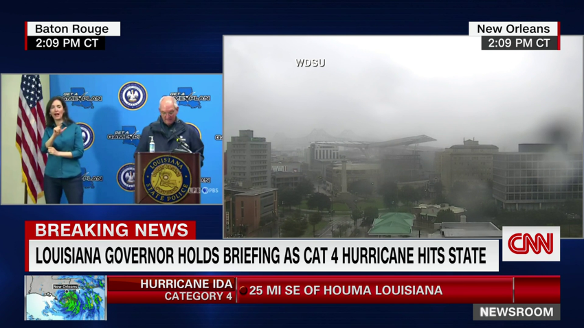
Louisiana Gov. John Bel Edwards told CNN Sunday night that Hurricane Ida is lashing his state and will continue to cause damage through the night.

Edwards said that he’s aware of calls for help — especially in Jefferson Parish where a mandatory evacuation was issued Thursday — but conditions will not allow for emergency crews to respond yet.

“At the height of a hurricane you can’t get first responders out because it’s just simply too dangerous. The wind speeds don’t allow for that,” he explained. “Just as soon as we can, we will be engaged in very robust search and rescue operations.”

There are 21 urban search and rescue teams from about 15 states ready to search when the storm calms, Edwards said. 

But he warned that the storm is far from over, noting that it hasn’t reach I-10 yet and the expected wind and rain, which could be 20 to 24 inches in those areas, is likely to cause further damage in the state.

“Nobody is out of the woods in southeast Louisiana yet. We’ll be dealing with this until sometime after midnight,” Edwards said, adding that the full extent of damage won’t be known until the sun comes up.

New Orleans' power outage triggered by "load imbalance," energy provider says

In an updated tweet Sunday night, energy provider Entergy says the power outage currently impacting all of Orleans Parish — including the City of New Orleans — was caused by “a load imbalance to the company’s transmission and generation.” 

“We’re making every effort to learn more and rectify,” Entergy says.

Every road in Lafourche Parish is impassable, sheriff says

Lafourche Parish Sheriff Craig Webre said every road in the parish is impassable at this hour, and agencies are unable to respond to calls for service at this time.

Webre joined CNN Sunday night after video emerged of Hurricane Ida pummeling the roof of a nearby hospital.

The Lady of the Sea General Hospital in Galliano, Louisiana, is stable after a portion of the facility’s roof was ripped off as Ida came ashore earlier in the day, Webre said.

There are still about ten patients in the hospital, the administrator and staff are still able to continue to care for those patients, and they were able to safely relocate to a lower floor, Webre said.  

Two of the three hospitals in Lafourche Parish sustained damage in Sunday’s epic storm, the sheriff added.

The county was also forced to relocate their emergency operations center to a different building after their first building’s roof began to leak earlier in the day on Sunday, Webre told CNN. 

New Orleans residents urged to limit water use as city-wide power outage hits sewer pumping stations

The Sewage and Water Board of New Orleans says the Parish-wide power outage is affecting its ability to operate its sewer pumping stations.

“Currently there is no backup power to operate any of those that were impacted,” the Board said in a statement to CNN. “We are assessing how many of the 84 stations are impacted but the number may be very significant.”

New Orleans residents need to begin limiting water usage at home, “in order to prevent sewage backups.

The board said they have obtained backup power for some of the stations, but they can only mobilize them, “when it is safe to traverse the city.” 

Currently, the Board said they are mustering all of their self-generated power sources to continue operating their stormwater draining, and drinking water pumping, operations.

“Although we have lost all Entergy power, our teams are working quickly and decisively to make up for this with our self-generated power sources,” the statement said. “The Entergy loss of power is a significant loss of power for our 60 hz pumps and the 25 hz pumps we power through the frequency changers, but we are using our self-generated sources of power to drain stormwater and pump drinking water into the city.”

Ida's center is now just west of New Orleans

The center of Hurricane Ida is 30 miles west of New Orleans, according to a 9 p.m. ET update from the National Hurricane Center.

Ida maintains Category 3 strength, but has weakened slightly with maximum sustained winds of 115 mph.

Hurricane-force winds continue to move through southern Louisiana along with heavy rain producing flash flooding.

Moments ago, regional energy provider Entergy moments ago reported all of Orleans Parish is without power “due to catastrophic transmission damage” caused by Hurricane Ida.

The news came from the City of New Orleans Office of Homeland Security and Emergency Preparedness, which shared the Entergy alert.

Another Louisiana parish issues a boil water notice

Jefferson Parish has issued a boil water advisory for the entire east bank of the parish, a tweet from the government said Sunday.

The advisory was issued “due to the loss of pressure in the distribution system,” according to the tweet. Jefferson Parish is west and south of New Orleans.

Parish President Cynthia Lee Sheng told CNN earlier that trees had fallen and their roots had come up, damaging water mains and causing the system to lose pressure.

All customers on the east bank are advised to continue to boil their water until the advisory has been rescinded, the tweet said. 

Earlier today, St. Charles Parish issued a precautionary water boil advisory, according to an emergency alert obtained by CNN. It came after officials received numerous reports of leaks.

All of New Orleans is now without power, officials say

All of Orleans Parish — which is the city of New Orleans — is without power, according to NOLA Ready, New Orleans’ emergency preparedness campaign.

If anyone in the parish has power, it’s coming from a generator, NOLA Ready says.

Across Louisiana, more than 700,000 customers are without power as Hurricane Ida continues to pound the coastal state.

Power outages are expected to continue increasing as the storm moves inland.

Barges have broken loose in one Louisiana parish because of Hurricane Ida, official says

St. Bernard Parish president Guy McInnis tells CNN that he has reports of 22 barges that have broken loose because of Hurricane Ida.

McInnis says that although he is not worried about the barges hitting a levee and damaging it, he is worried that they may hit other infrastructure in the Parish. 

Specifically, McInnis is concerned about the barges damaging the Parish’s water intake and refinery infrastructure. Because the winds are still very high, McInnis says the Coast Guard is waiting for the winds to die down before they can try and moor the loose barges.

Aside from the loose barges, McInnis says that they continue to be inundated with wind and rain as Hurricane Ina continues to lash the Parish. 

He said that the wind has been nothing like he’s ever seen.

“The relentless wind that we’ve been getting over the extended period of time is something that I wasn’t expecting,” McInnis said. “The northerly turn that this storm took kept the edge of the eyeball very close to us; I haven’t seen relentless wind [like this] in my lifetime.”

The sun's setting in Louisiana. Here's what you need to know about Hurricane Ida.

Daylight is fading in Louisiana as Hurricane Ida continues to batter the state. The storm will continue to move northward through the night.

If you’re just reading in now, here’s what you need to know about Ida as night falls on the Gulf Coast:

  • Landfall on a poignant anniversary: Ida made landfall around 1 p.m. ET today as a Category 4 hurricane with top winds of 150 miles per hour. Ida hit on the 16th anniversary of the historically devastating Hurricane Katrina.
  • Ida stayed a Category 4 hurricane for hours after landfall: Ida was downgraded to a Category 3 storm in a 7 p.m. ET update from the National Hurricane Center, about six hours after it mad landfall. This is quite a long time: For reference, Hurricane Laura, which hit Louisiana last year, went from a 150 mph Category 4 storm to 120 mph Category 3 storm in 3 hours after landfall — so Ida maintained Category 4 strength after landfall for twice as long.
  • New Orleans is under a flash flood warning: Ida is now making its closest pass at New Orleans, and it’s about 25 miles west-southwest of the city. There’s a flash flood warning in effect for New Orleans and parishes around the city, according to the National Weather Service. The warnings will last until at least 11 p.m. ET, or 10 p.m. local time.
  • More than 700,000 are in the dark: More than 700,000 customers are without power in Louisiana as Hurricane Ida continues to pound the coastal state. Power outages are expected to continue increasing as the storm moves inland.

More than 700,000 customers are without power in Louisiana as Ida crawls through state

More than 700,000 customers are without power in Louisiana as Hurricane Ida continues to pound the coastal state.

Poweroutage.us is reporting 720,279 outages as of 8 p.m. ET.

That is an increase of more than 215,000 in the last two hours: At 6 p.m. ET, there were 504,149 customers without power.

Power outages are expected to continue increasing as the storm moves inland.

Hurricane Ida is making its closest pass to New Orleans now

Hurricane Ida continues to push inland while slowly weakening with top winds of 120 mph, per the 7 p.m. CDT update from the National Hurricane Center. Hurricane-force winds stretch for 45 miles from the storm’s center. 

Ida is currently making its closest pass to New Orleans, and the storm is located 25 miles west-southwest of the city. 

A wind gust of 83 mph was felt at New Orleans International Airport last hour. New Orleans will be seeing their highest winds and heaviest rainfall within the next hour or two.

The tornado threat continues to mount, and a new tornado watch was just issued that includes portions of southern Mississippi, Alabama and the Florida Panhandle, in addition to far eastern Louisiana. The tornado watch is in effect until 7 a.m. ET tomorrow. 

"Catastrophic" conditions continue in Louisiana, according to the National Hurricane Center's latest update

Hurricane Ida is still a Category 3 hurricane as it continues to creep northward through Louisiana, according to the National Hurricane Center’s latest update.

Ida is about 25 miles west southwest of New Orleans now, and it has sustained winds of 120 mph.

Here’s a look at the latest forecast path, according to the National Hurricane Center:

Ida remained a Category 4 hurricane for about 6 hours after landfall

Hurricane Ida lashed the state of Louisiana as a Category 4 storm for about six hours after it made landfall.

Ida was downgraded to a Category 3 storm in a 7 p.m. ET update from the National Hurricane Center. It made landfall as a Category 4 storm around 1 p.m. ET.

For reference, Hurricane Laura, which hit Louisiana last year, went from a 150 mph Category 4 storm to 120 mph Category 3 storm in 3 hours after landfall. Hurricane Michael in 2018 went from 155 mph to 125 in 3 hours post landfall. 

So Hurricane Ida maintained Category 4 strength after landfall for twice as long as those two storms.

So what’s the difference between categories anyway? The National Hurricane Center uses the the Saffir-Simpson Hurricane Wind Scale to rate hurricanes. According to the scale, Category 4 hurricanes have sustained winds between 130 and 156 mph, and they will produce “catastrophic damage.”

“Well-built framed homes can sustain severe damage with loss of most of the roof structure and/or some exterior walls. Most trees will be snapped or uprooted and power poles downed. Fallen trees and power poles will isolate residential areas. Power outages will last weeks to possibly months. Most of the area will be uninhabitable for weeks or months,” the center says of Category 4 storms.

Meanwhile, Category 3 storms — which produce “devastating damage” — have sustained winds between 111 and 129 mph.

“Well-built framed homes may incur major damage or removal of roof decking and gable ends. Many trees will be snapped or uprooted, blocking numerous roads. Electricity and water will be unavailable for several days to weeks after the storm passes,” the center says.

Louisiana's St. Charles Parish issues precautionary boil advisory

After receiving numerous reports of leaks, St. Charles Parish says it has issued a precautionary water boil advisory, according to an emergency alert obtained by CNN.

“While the Department of Waterworks is currently maintaining positive pressure and all of the storage tanks are full, this precautionary measure is being put in place to ensure the quality of water,” the alert reads. “Additionally, residents should continue to limit non-essential water and sewerage such as washing dishes, cleaning clothes and showering. Flushing toilets is ok.”

St. Charles Parish is just west of New Orleans.

JUST IN: Ida weakens to a Category 3 storm

Hurricane Ida has weakened slightly to a Category 3 storm with maximum sustained winds of 125 mph, according to a 7 p.m. ET update from the National Hurricane Center.

Ida made landfall earlier today as a Category 4 storm and kept that status for hours as it moved northward into Louisiana. Category 4 hurricanes have sustained winds between 130 and 156 mph, while Category 3 storms have sustained winds between 111 and 129 mph.

The center of the storm is now located 30 miles southwest of New Orleans.

While the eye will pass west of New Orleans, conditions there will deteriorate rapidly in the next few hours as higher winds arrive, along with torrential flooding rain.  

Catastrophic storm surge, extreme winds, and flash flooding continue in portions of southeastern Louisiana.

Louisiana State University closed through at least Tuesday for Ida

Louisiana State University will be closed at least through Tuesday “due to the expected impacts of Hurricane Ida,” the LSU Office of Emergency Preparedness said in a message to the LSU community Sunday.

The University had previously announced it would be closed through Monday due to the hurricane.

Residence halls are open and on-campus residents were told to get extra takeout meals in advance of the hurricane, as the dining halls are not open, according to the message.

“Please shelter in place during the storm, and do not go outdoors, as flying debris and other hazardous conditions will exist. After the storm, please continue to stay off roads and use caution, as power lines and trees may be down, roads may be blocked, and flash flooding may be occurring,” the message said. “Those who live off campus are asked not to come back to campus until we reopen, unless you are essential personnel instructed to do so by your supervisor. This will allow LSU Police and Facility Services time to assess and clean up the campus.”

The university said any changes to the academic calendar would be announced after the hurricane.  

LSU is located in Baton Rouge, about 130 miles northwest of Port Fourchon, Louisiana, where Ida made landfall earlier today.

Here's what it looks like in Louisiana's St. Bernard Parish

Security camera footage captured roaring waters and whipping winds in Louisiana’s St. Bernard Parish as Hurricane Ida continues to churn over the state.

St. Bernard Parish — just southeast of New Orleans — posted the video to Twitter:

Louisiana governor requests major disaster declaration as Ida pummels state

Louisiana Gov. John Bel Edwards on Sunday requested a Presidential Major Disaster Declaration as his state continues to be pummeled by Hurricane Ida, according to a press release from his office.

“Hurricane Ida is one of the strongest storms to ever hit Louisiana. It is our goal to assist our local agencies and the citizens of the state as quickly as possible, and we have pre-positioned search and rescue teams, boats and other assets to begin helping people as soon as it is safe,” Edwards said in a press release Sunday.

“This major disaster declaration will help Louisiana better respond to this crisis and protect the health and safety of our people, and I hope the White House will act quickly so we can begin getting additional aid and assistance to our people,” the governor added.

Edwards has requested federal public assistance related to emergency protection actions, shelters and temporary housing costs, his office said. Also included is a request for federal assistance for debris removal and infrastructure damage, according to the press release.

On Friday, the Biden administration approved Edwards’ request for a Federal Declaration of Emergency prior to Ida making landfall, CNN previously reported. 

911 and the sheriff office's phone lines are down in this Louisiana parish

Officials in Lafourche Parish, Louisiana, hit hard by Hurricane Ida, says their 911 line and Parish Sheriff Office phone lines are down.

CNN obtained an emergency alert sent out to residents in Lafourche Parish, which alerted the outage. 

No reason was given for the outage, but much of the Parish is being inundated with wind, rain and storm surge from Hurricane Ida.

Those with emergencies should call 985-772-4810 or 985-772-4824.

Plaquemines Parish says there are reports of a levee overtopping

Rainfall and storm surge from Hurricane Ida is causing a levee to overtop on the east bank of Plaquemines Parish between the Parish line and White Ditch, according to the New Orleans National Weather Service office, which shared an update from the Plaquemines Parish government.

A flash flood emergency is in effect for parts of Plaquemines Parish, including the Braithwaite area, and residents are urged to seek higher ground.

Ida is still a Category 4 storm as it crawls northward through Louisiana

The center of Hurricane Ida is passing just east, about 5 miles, from Houma, Louisiana, at 5 p.m. local time, which is 6 p.m. ET.

Ida is currently located about 40 miles southwest of New Orleans and maximum sustained winds remain at 130 mph, meaning it’s still a Category 4.

Category 4 hurricanes have sustained winds between 130 and 156 mph

Damaging wind gusts continue to be reported. A station at the South Lafourche Airport recently had a gust to 122 mph. Winds also continue to pick up in New Orleans, with a wind gust of 83 mph reported at New Orleans Lakefront Airport last hour.

More than half a million are now without power in Louisiana

More than 500,000 customers are now without power in Louisiana as Hurricane Ida continues to slam the state, according to Poweroutage.us. 

There are 504,149 customers without power as of 6 p.m. ET, another increase of more than 100,000 customers within 90 minutes.

Power outages are expected to continue increasing as the storm moves inland.

It's just past 5 p.m. in Louisiana. Here's what you need to know about Ida now.

Hurricane Ida is still a Category 4 storm hours after making landfall near Port Fourchon, Louisiana.

It’s just past 5 p.m. in the state now — here’s where things stand:

  • Winds have weakened just slightly: Hurricane Ida’s top wind speeds have decreased slightly, down to 130 mph, meaning it’s still a Category 4 storm, but just barely (Category 4 hurricanes have sustained winds between 130 and 156 mph). When Ida made landfall earlier today, it had winds of 150 mph.
  • The storm has slowed down: Hurricane Ida’s forward speed has slowed down and the storm is only moving to the northwest at 10 mph. This will increase the flooding potential, as well as the amount of time the winds will last over inland locations.
  • New Orleans is under a flash flood warning: There’s a flash flood warning now in effect for New Orleans and parishes around the city, according to the National Weather Service. The warnings will last until at least 11 p.m. ET, or 10 p.m. local time.
  • A poignant anniversary: Ida hit on the 16th anniversary of the historically devastating Hurricane Katrina. As a Category 4 hurricane with winds of 150 mph, it tied at the state’s most powerful storm ever with Laura from last year and the Last Island Hurricane of 1856.

What it looks like on the ground as Ida lashes Louisiana

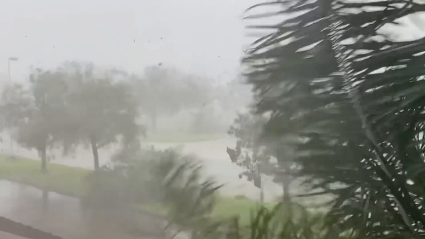
Winds are whipping and trees are down in Houma, Louisiana, as Hurricane Ida blasts the region.

CNN meteorologist Derek van Dam is in Houma — which is about 60 miles northwest of Port Fourchon, where Ida made landfall earlier today — and took video of the dangerous conditions from a balcony

Here’s what it looks like:

92112bc1-bf25-45e3-8eaa-c6ec4fd21ce9.mp4
00:25 - Source: cnn

New Orleans is now under a flash flood warning

There’s a flash flood warning now in effect for New Orleans, according to the National Weather Service in the city.

Flash flood warning have also been issued for…

  • Northwestern Jefferson Parish in southeastern Louisiana
  • Northwestern Plaquemines Parish in southeastern Louisiana
  • West Central St. Bernard Parish in southeastern Louisiana
  • Northwestern St. Charles Parish in southeastern Louisiana
  • West Central St. John The Baptist Parish in southeastern Louisiana

The warnings will last until at least 11 p.m. ET, or 10 p.m. local time.

Ida's winds have weakened slightly — but it's still a Category 4 storm

Hurricane Ida continues to push through southeastern Louisiana on Sunday afternoon, and is currently located 45 miles southwest of New Orleans, according to the 5 p.m. ET update from the National Hurricane Center. 

Ida’s top wind speeds have decreased slightly, down to 130 mph, which still makes it a Category 4 storm. 

Hurricane Ida’s forward speed has slowed down and the storm is only moving to the northwest at 10 mph. This will increase the flooding potential, as well as the amount of time the winds will last over inland locations.

Chef Jose Andres sets up 3 kitchens to serve more than 100,000 meals in New Orleans

Chef Jose Andres and his World Central Kitchen organization are on the ground in New Orleans and have set up three kitchens with enough food to serve more than 100,000 meals, he said on Twitter Sunday afternoon.

Andres and his team are sheltering-in-place until Hurricane Ida passes, and he’s encouraged by the pre-positioning he’s seen from both the federal government and non-governmental organizations since he arrived in New Orleans on Saturday night.

Andres says the kitchens are stocked, the food is on-sight and they will be operational once it is safe to do so.

He left Haiti on Saturday and his World Central Kitchen site there to assemble a team in New Orleans ahead of the storm.

Ida made landfall near Port Fourchon, Louisiana, earlier today. The storm is about 45 miles southwest of New Orleans.

Here's the latest update on Ida from the National Hurricane Center

Hurricane Ida is still a Category 4 storm with maximum sustained winds of 130 mph, according to the National Hurricane Center’s 5 p.m. ET advisory.

Category 4 hurricanes have sustained winds between 130 and 156 mph, so Ida is holding onto the status by a thread — but it’s still a dangerous storm.

The storm is about 45 miles southwest of New Orleans.

Here’s a look at the storm’s latest forecast path:

Colonial Pipeline temporarily shuts pair of fuel lines as Hurricane Ida strikes

Colonial Pipeline, which bills itself the largest refined products pipeline in the US, is temporarily shutting down two fuel lines between Houston, Texas, and Greensboro, North Carolina, as a precaution due to Hurricane Ida, the pipeline’s operator said Sunday afternoon. 

Lines 1 and 2 were shuttered “as a precautionary and routine safety measure,” Colonial Pipeline said in a statement. Lines 3 and 4, which carry fuel from Greensboro to Linden, New Jersey, have not been impacted and remain operational, they said. 

The pipeline operation emphasized that fuel supply continues to be available “throughout the southeast” from numerous terminals located along the supply route.

Some context: The 5,500-mile Colonial Pipeline provides nearly half the gasoline and diesel consumed by the East Coast, making it one of America’s most important pieces of energy infrastructure.

Colonial Pipeline said it expects to get back to full service after evaluating its infrastructure and executing a startup plan.

“This is temporary,” Colonial Pipeline spokesperson Eric Abercrombie told CNN. “We do this as a safety precaution during severe weather events.”

For instance, Colonial Pipeline said it shut down fuel lines due to an ice storm earlier this year as well as during two hurricanes last year.

In May, the Colonial Pipeline was knocked offline for six days by a ransomware attack that caused panic-buying in the Southeast. 

More than 400,000 customers are now without power as Ida moves through Louisiana

More than 400,000 customers are now without power in Louisiana as Hurricane Ida moves through the state, according to Poweroutage.us.

There are 410,577 customers without power as of 4:30 p.m. ET.

Power outages are expected to continue increasing as the storm moves inland.

Mississippi River flow reversing due to hurricane "extremely uncommon," USGS says

Storm surge and strong winds stopped the flow of the Mississippi River on Sunday near New Orleans and actually caused the flow to reverse – something the United States Geological Survey said is “extremely uncommon.”

“I remember, offhand, that there was some flow reversal of the Mississippi River during Hurricane Katrina, but it is extremely uncommon,” Scott Perrien, a supervising hydrologist with the USGS Lower Mississippi Gulf Water Science Center in Baton Rouge, Louisiana, told CNN.

Perrien noted that the river level rose about 7 feet due to the storm surge pushing up the river at the USGS gauge, located in Belle Chasse, about 20 miles south of New Orleans in southeastern Louisiana.

“During that time, the flow of the river slowed from about 2 feet per second down to about half a foot per second in the other direction,” Perrien said.

Perrien pointed out that the gauge does not measure the flow of the entire river, so it is possible that the deeper portions of the river did not reverse flow directions.

“The river is feeling the effects of the storm over a large area,” Perrien said, “all the way up to Baton Rouge the river has risen 1.5 feet in the past 12 hours as the surge pushes up the river. And the water level will likely rise more in the coming hours here in Baton Rouge.”

Extensive flooding seen in Grand Isle, Louisiana

Grand Isle Marina in Grand Isle, Louisiana, shared surveillance video showing the venue flooded as Ida works its way through the area Sunday.

Watch:

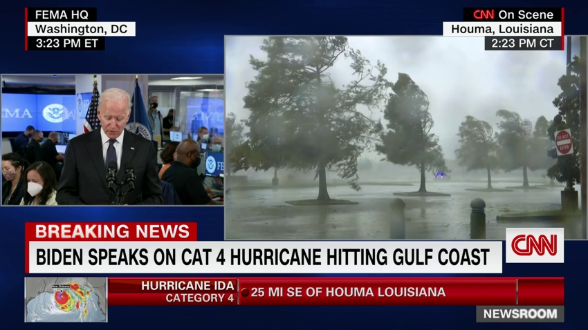
Biden urges residents in Ida's path to take the storm "very seriously"

President Biden urged residents to listen to officials and stay safe as Hurricane Ida lashes Louisiana’s coast.

“The storm is a life-threatening storm. … And its devastation is likely to be immense. We shouldn’t kid ourselves. And so the most important thing I can say right now is that everyone, everyone should listen to the instructions from local and state officials, just how dangerous this is. And take it seriously. It’s not just the coasts. It’s not just New Orleans. It’s north as well. The rainfall is expected to be exceedingly high,” Biden said while getting a briefing on the storm at Federal Emergency Management Agency offices.  

Biden pledged to put “the country’s full might” behind rescue and recovery efforts.

“We’re going to be here. We’re going to be here to help the Gulf region get back on its feet as quickly as possible, as long as it takes,” he said.

“We should be prepared that it can take a long time no matter how much we’ve prepositioned — which we have — that is going to take a long time for a lot of them to get back up. It could take a matter of weeks for some places,” the President said.

Watch President Biden:

a748008d-954a-4b46-8336-66bfd905cb72.mp4
00:54 - Source: cnn

Catch up: What you need to know about Hurricane Ida's landfall and where it's going next

Hurricane Ida slammed into Louisiana’s coast near Port Fourchon earlier today as a Category 4 storm. If you’re just reading in now, here’s the latest on the hurricane:

  • The storm is far from over: Landfall is when the eye is halfway over the coast. Extreme winds and surge will accompany the 1 p.m. ET landfall over the next several hours. A tornado watch is in effect until 8 p.m. ET for parts of Alabama, Florida, Louisiana and Mississippi, according to the Storm Prediction Center. Quick-moving, brief tornadoes will be possible throughout today. There is also a danger of life-threatening storm surge Sunday in areas along the coasts of Louisiana, Mississippi and Alabama.
  • The effects so far: More than 285,000 customers are without power in Louisiana so far. Meanwhile, Airlines canceled all flights arriving to and leaving from Louis Armstrong New Orleans International Airport on Sunday, the airport said. And Tulane University in New Orleans is closed Sunday and Monday, less than a week after students returned to campus.
  • Ida’s path: The hurricane is expected to travel northward through Louisiana today, according to the latest advisory from the National Hurricane Center. It will curve eastward as it keeps traveling north through Mississippi tomorrow.
  • A poignant anniversary: Ida hit on the 16th anniversary of the historically devastating Hurricane Katrina. As a Category 4 hurricane with winds of 150 mph, it tied at the state’s most powerful storm ever with Laura from last year and the Last Island Hurricane of 1856.

Here are the supplies FEMA has sent to Louisiana so far

The Federal Emergency Management Agency has sent the following supplies to Louisiana ahead of Hurricane Ida making landfall, according to spokesperson Jaclyn Rothenberg:

  • 200 ambulances
  • 139,000 tarps (includes tarps sent to Mississippi)
  • 3.5 million meals (includes meals sent to Mississippi)
  • 2.5 million liters of water

There are 22 federal agencies supporting the effort, Rothenberg added. Millions more meals and liters of water are on their way, she said.

Fire station in Delacroix, Louisiana, shares video of intense storm damage

A fire station in Delacroix, Louisiana, shared a video of the devastation Hurricane Ida is causing in just a short period of time.

Watch:

Louisiana governor says Ida is "one of the strongest storms to make landfall here in modern times"

Louisiana Gov. John Bel Edwards said today that Hurricane Ida is one of the strongest storms to make landfall in Louisiana in modern times, as it rapidly intensified at an unprecedented rate, right up until landfall.

The governor urged residents to remain indoors and to be patient, as the state does not know how soon first responders will be able to respond to calls for assistance.

“Once the storm has passed, you need to be prepared to shelter in place for the first 72 hours,” Edwards said. “We have every possible resource ready to go, to help you. We’ll get there sooner than 72 hours if at all possible, in order to rescue people across the state of Louisiana.”

The entirety of the Louisiana National Guard has been activated and currently more than 4,900 guardsmen are staged across 14 parishes. They have 195 high water vehicles, 73 boats, and 34 helicopters ready to support and assist the citizens, the governor said.

According to the governor, all of the state’s Hurricane Protection Systems have been completely closed and all structures are fully operational at this time, though overtopping in some southeast portions are anticipated.

“Obviously overtopping is concerning, but I want to make sure that everybody understands overtopping and levee failure are not the same thing,” Edwards said.

Overtopping of New Orleans levees not expected, Louisiana governor says

Louisiana Gov. John Bel Edwards said officials do not expect overtopping of levees in the New Orleans area due to Hurricane Ida.

“I can tell you right now we do not anticipate any overtopping of the Mississippi River levees or overtopping of the levees in the Hurricane Risk Reduction System around the greater New Orleans area,” Edwards said in a news conference.  

The Hurricane Storm Damage Risk Reduction System is a flood prevention system constructed after Hurricane Katrina in 2006. Hurricane Ida made landfall 16 years after Katrina.

Edwards said that floodwaters may crest over levees in certain other areas, including portions of the Larose to Golden Meadow levee system, and non-federal levees in Plaquemines and lower St. Bernard parishes.

“Obviously, overtopping is concerning, but I want to make sure that everybody understands, overtopping and levee failure are not the same thing. A levee failure can be much more catastrophic,” he said.

WATCH:

b297fb0c-10da-428c-96f0-e07eef7c88e2.mp4
01:18 - Source: cnn

More than 285,000 customers without power as Ida hits Louisiana

More than 285,000 customers are without power in Louisiana as Hurricane Ida drives into the state, according to Poweroutage.us.

There are 285,477 customers without power as of 3 p.m. ET.

There were about 150,000 customers without power just before 2 p.m. ET.

Baton Rouge hospital plans for possibility of caring for Covid-19 patients in hallways, medical officer says

Dr. Katherine O’Neal, chief medical officer or Our Lady of the Lake Regional Medical Center in Baton Rouge, said that while her hospital is ready to sustain Hurricane Ida, it will be stretched thin due to the influx in Covid-19 patients.

“This hospital is ready to sustain quite a bit of damage, ready to sustain quite a bit of power outages. We’re talking about rationing supplies, getting ready for days of having our team here, but we have the ability to do that. What we don’t have is space and what we don’t have are health care workers because of Covid. We have 619 people in-house today. We have 157 Covid patients, which is just unbelievable and still higher than we’ve ever seen in this pandemic before,” she told CNN’s Wolf Blitzer.

Louisiana Gov. John Bel Edwards earlier said that Ida “presents some very challenging difficulties for us with the hospitals being so full of Covid patients.”

O’Neal said the hospital is planning for all scenarios.

“What we’re planning for today is taking more patients, even though we’re at capacity. We’ll need to take the patients into our halls,” O’Neal said. “And then different from any storm, how do we take the health care workers with them? We’ll need them to help take care of these patients. We don’t have enough here to stretch beyond the patients that we have in-house.”

Both day-shift and night-shift health workers are at the hospital, and there are 600 mattresses on hand for them to use “for the long run,” she said. But health workers are exhausted due to the pandemic, O’Neal said, and now have added stress due to the storm.

“They left their families to evacuate; they left their families to not know what their houses are going to be like or be able to communicate,” she said.

Hurricane Ida shuts down 95% of Gulf of Mexico's oil production

More than 95% of the Gulf of Mexico’s oil production has been shut down thanks to Hurricane Ida, regulators said Sunday, indicating the hurricane is having a significant impact on energy supply.  

As of 11:30 a.m. CT, personnel have been evacuated from a total of 288 oil-and-gas production platforms, according to the Bureau of Safety and Environmental Enforcement. That represents about 51% of the manned platforms in the Gulf of Mexico.

The agency said all 11 rigs in the Gulf of Mexico have also been evacuated, and a total of 1.7 million barrels of daily oil production in the Gulf of Mexico has been shut-in – the equivalent to 95.7% of the region’s total output. 

The widespread loss of oil supply from one of America’s energy hubs is likely to lift prices.  US oil prices rose sharply last week ahead of Hurricane Ida’s arrival. 

Oil futures are set to begin trading at 5 p.m. ET on Sunday.

More than 200,000 customers are without power as Ida moves through Louisiana

There are now more than 200,000 customers without power in Louisiana as Hurricane Ida maneuvers inland.

According to poweroutage.us, 223,680 customers are without power as a result of Hurricane Ida, an increase of more than 73,000 in around 30 minutes. There were 150,012 customers without power at 1:54 p.m. ET.

Power outages are expected to continue as the storm moves inland.

Extreme wind warning west of New Orleans

A new extreme wind warning is in effect for locations further inland than the previous warning, which just expired, due to Hurricane Ida.

This new warning is in effect until 4:30 p.m. CDT and spans from the coast through the southwestern corner of Lake Pontchartrain, including Houma, Laplace and Bayou Cane in Louisiana.

“Widespread destructive winds of 115 to 135 mph will spread across St. John The Baptist, St. James, St. Charles, Terrebonne, Lafourche, Jefferson, Plaquemines and Assumption Parishes, producing swaths of tornado-like damage,” the National Weather Service in New Orleans warned.

People have been asked to seek shelter over the next few hours as the NWS warns that it’s “an extremely dangerous and life-threatening situation!”

More than 300,000 people normally reside in the area of this warning.

Hurricane Ida storm surge and winds have partially reversed flow of Mississippi River near New Orleans

Data from the US Geological Survey (USGS) indicates that the flow of the Mississippi River in New Orleans has partially reversed its flow due to the strong storm surge and winds from Hurricane Ida pushing up the river. 

The river gauge at Belle Chasse, just southeast of central New Orleans, shows the surface velocity of the water slowing significantly on Sunday morning from 2 feet per second down to zero by 10 a.m. CDT.

The flow rate has been negative for the past three hours, reaching a peak of -0.21 feet per second at 12:45 p.m CDT.

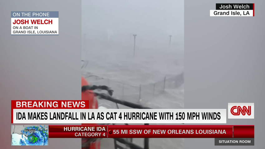
Man says he's riding out Hurricane Ida on a boat

Josh Welch is riding out Hurricane Ida on a boat in Grand Isle, Louisiana.

“A lot of wind and rain right now. I mean, you can’t even see the dock or nothing. It used to be a dock over, I guess, but it ain’t no more,” he told CNN. “It’s pretty bad right now.”

Welch said four men are on the boat with him.

“We realized we was trapped” by the time conditions deteriorated, he said.

He said his cell phone is in and out of service and he’s “shocked” the cell tower is still up.

Welch said this is the first time he’s ever experienced anything like this. He’s seen other hurricanes, but “this is the first time I’ve actually been in one.” 

Watch the interview:

dc84c103-4e89-4aa8-a1fe-c6798b8f1139.mp4
02:20 - Source: cnn

New Orleans EMS suspends operations as Ida continues moving inland

New Orleans Emergency Management Services said Sunday it has suspended all operations as Hurricane Ida makes landfall.

“NOEMS operations have been suspended due to dangerous winds,” the department said in a tweet Sunday.

NOEMS said operations will resume once conditions are safe for first-responders.

Tornado watches issued within storm

Tornadoes may spin up now that Hurricane Ida is moving ashore. A tornado watch is in effect for portions of Louisiana, Mississippi, Alabama and Florida. The threat of a few tornadoes will increase throughout the day and into the evening. 

“Hurricanes and tropical storms that make landfall in the Gulf of Mexico are more likely to produce tornadoes compared to storms in the Atlantic,” explains Brandon Miller, CNN meteorologist.

It is important to note because the threat of tornadoes is not limited to the coastline or to the day of landfall. 

Often, the day after landfall can produce more tornadoes than on the landfall day itself, and they can occur hundreds of miles inland.

Know the difference between a watch and a warning.

Here's what Hurricane Ida looks like from space

International Space Station crew member Thomas Pesquet captured a photo of Hurricane Ida from space just a few hours before it made landfall in Lousiana.

“Observing hurricanes from space helps us work with partner agencies like @NOAA and @FEMA to support preparation and disaster response,” NASA tweeted along with the image.

See the tweet:

Hurricane Ida tied for strongest storm to ever hit Louisiana

With Hurricane Ida making landfall as a 150 mph Category 4 hurricane, it is now tied for the strongest storm to ever make landfall in Louisiana. 

By the numbers:

  • Hurricane Ida ties Laura (2020) and the Last Island Hurricane in 1856 as the strongest to hit LA (all had 150 mph top winds).
  • Louisiana becomes the first US state to record a 150+ mph hurricanes in back-to-back years (Laura and Ida)
  • A 150 mph Category 4 hurricane has more than 250 times the damage potential of a 75 mph Category 1 storm, per NOAA analyses
  • Hurricane Ida’s hurricane-force winds extend 50 miles from the center, and tropical storm-force winds stretch 150 miles from center. The center is forecast to pass about 30 miles west of New Orleans.
  • New Orleans has received over 65 inches so far this year, their second wettest on record to this point of the year. This will make flooding in the region worse. New Orleans is expecting 15-20 inches of rain with Ida. 

A number of New Orleans sewage and pump stations are experiencing power outages

The Sewage and Water Board of New Orleans (SWBNO) said Sunday that there are a number of sewage pump stations on both the East and West Banks of New Orleans currently experiencing power outages.

“This increases the potential for sewer backups in homes. We urge those residents who still have power to minimize wastewater leaving their homes by not running your dishwasher or washing clothes,” the board said in a tweet Sunday.

SWBNO said those stations will be out of service until Hurricane Ida passes and it is safe for SWBNO to make assessments. However, generators are being deployed to assist with the outages at the pump stations, according to Ramsey Green, deputy chief administrative officer for infrastructure with New Orleans.

 “If you don’t need to use water, don’t use it for the moment. Okay, for the moment, you don’t need to use water. Just be conservative with it,” Green said.

More than 100,000 customers without power as Hurricane Ida slams into Louisiana

There are now more than 100,000 customers without power in Louisiana as Hurricane Ida bears down.

According to poweroutage.us, 104,892 customers are without power as a result of Hurricane Ida, an increase of more than 24,000 in just 50 minutes.

There were 80,154 customers without power at 12:24 p.m. ET.

Power outages are expected to increase as the storm moves inland.

Hurricane Ida makes landfall in Louisiana

Hurricane Ida has made landfall near Port Fourchon, Louisiana, as an extremely dangerous, Category 4 hurricane with winds of 150 mph, according to the National Hurricane Center. 

More from the NHC:

Lousiana's St. John the Baptist Parish enacts curfew ahead of Hurricane Ida

St. John the Baptist Parish has enacted a parish-wide curfew starting tonight, according to an emergency alert.

The curfew starts tonight at 6 p.m. p.m. local time, and lasts until 7 a.m.

The parish is located two parishes west of New Orleans and is bordered by three lakes: Lake Pontchartrain, Lake Maurepas, and Lac des Allemands.  

Video shows deteriorating conditions on Grand Isle, Louisiana, as Ida approaches

Joshua Legg stayed on Grand Isle, Louisiana, to ride out Hurricane Ida and witness the worsening conditions as the storm approaches.

“We’re losing roofs right now,” Legg, who is a former police officer, told CNN over Facebook.

Legg said his home is safe and he is in a “cat5 rated structure.” He said he was a police officer for 15 years and still works with SAR (Search and Rescue) to help his community. 

Watch:

Here's what it looks like inside the eye of Hurricane Ida

A National Oceanic and Atmospheric Administration plane captured video from inside the eye of Hurricane Ida on Sunday morning.

Watch:

Energy provider says some residents could be without power for weeks due to Hurricane Ida

As Hurricane Ida approaches the coast of Louisiana, Energy Louisiana said Sunday some of its customers could be without power for weeks.

“The extremely dangerous storm is expected to make landfall in southeastern Louisiana in the early afternoon today and move through Mississippi. Those in the hardest-hit areas could experience power outages for weeks,” the company said in a statement

The company warned that while 90% of customers will likely have their power restored in a timely manner, flooding and storm damage may prevent crews from accessing certain areas. 

The company said it expects to deploy around 16,000 restoration personnel once the storm passes. 

“Crews are standing by to assess damages and quickly and safely restore power as conditions allow. With the additional requested resources, we anticipate mobilizing a storm team of about 16K to support restoration efforts,” Energy Louisiana tweeted.

According to its website, Entergy delivers electricity to 3 million utility customers in Arkansas, Louisiana, Mississippi, and Texas. Entergy Louisiana serves approximately 1.1 million electric customers in 58 parishes, the company says.

There are nearly 77,000 customers without power throughout the state currently, according to poweroutage.us.

Ida's extremely dangerous eyewall is moving onshore in southeast Louisiana

The very dangerous northern eyewall of Hurricane Ida is moving onshore along the southeast Louisiana coast, according to the 12 p.m. EDT update from the National Hurricane Center. 

The eyewall is the most dangerous part of a hurricane, which contains the highest winds. 

The storm continues to pack winds of 150 mph with higher gusts and is still an extremely dangerous, Category 4 hurricane.

The center of Ida was located around 25 miles from Grand Isle, Louisiana. A wind gust of 104 mph was recently reported at Southwest Pass, Louisiana. 

Ida will be making landfall over the next hour or so when the center of the eye is halfway over the coast. Extreme winds and surge will accompany landfall over the next several hours.

More than 65,000 customers without power as Ida bears down on the Louisiana coast

There are more than 65,000 customers without power in the state of Louisiana as a powerful Category 4 Hurricane Ida approaches the coast.

There are 65,535 customers without power as a result of Hurricane Ida, according to poweroutage.us.

Jackson Public Schools in Mississippi cancels school due to Hurricane Ida

The Jackson Public School District in Mississippi announced Sunday it is canceling school and extracurriculars Monday as the state braces for Hurricane Ida. 

“All schools, offices, and departments in the Jackson Public School District will be closed Monday, August 30, due to the threat of severe weather conditions resulting from Hurricane Ida,” the school district said on its website. “All extracurricular activities and practices will also be canceled.”

According to its website, JPSD is the second-largest school district in the state and serves around 21,000 students.

JPSD said its personnel will continue monitoring the situation and provide updates through its website and social media platforms.

Home security cameras show water rising in Louisiana

Louisiana resident Sharlette Landry’s home security cameras captured footage of water quickly rising in her home before it lost power ahead of Hurricane Ida.

“I did prepare, but you can never be prepared for this magnitude of a storm,” said Landry, who had evacuated her home in Grand Isle ahead of the storm. “I was very surprised at how fast it rose. I’ve never seen it that high, and I’m sure it’s higher now at my place.”

Watch:

Lousiana's St. Tammany Parish issues parish-wide curfew starting at noon

St. Tammany Parish has issued an executive order declaring a parish-wide curfew, effective at noon (1 p.m. ET) today, including all municipalities, parish president Michael Cooper said.

The curfew will be in effect until the danger of Hurricane Ida has passed, the parish president said. 

While the curfew is in effect, the only vehicles allowed on the streets within the parish will be those necessary to address life-threatening emergencies, and those under the direction of first responders and utilities, Cooper said.

Landfall of Hurricane Ida is expected shortly, as the parish prepares for 10 inches or more of rain and the possibility of tornadoes. Local roadways are expected to be inundated and impassable because of high water, downed trees and downed power lines, Cooper said.

The parish is planning for widespread power outages, with current reports of over 7,500 power outages already, Cooper said.

2,400 FEMA personnel deployed throughout Southeast to assist with hurricane impacts 

The Federal Emergency Management Agency (FEMA) said Sunday it has deployed more than 2,400 personnel in Alabama, Florida, Georgia, Louisiana, Mississippi, and Texas to assist with the response to Hurricane Ida.

“FEMA is working with its federal, state and local partners as well as non-governmental agencies to support needs of areas affected by Ida. The agency positioned supplies such as meals, water, and generators to assist states with impacts from this storm,” the agency said in a news release Sunday.

FEMA has deployed Incident management assistance teams and liaison officers and set up incident support bases throughout the region.

Deployed assets include 12 urban search and rescue teams in Alabama and Louisiana and a US Army Corp of Engineers power restoration team. 

More than 90 ambulances and emergency medical providers are on stand-by and will assist with evacuations, the statement said. FEMA has deployed air-born ambulances as well, including eight fixed-wing and seven rotary models.

FEMA said 2.5 million meals and 3.1 million liters of water are staged and ready for distribution.

Additional federal assistance teams have been deployed from other agencies as well.

CNN’s Catherine Carter contributed to this report

Extreme wind warning extended in Louisiana

The extreme wind warning remains in effect for southeastern parts of Louisiana now until 1:30 p.m. CDT. 

The National Weather Service is warning people in the area to treat the situation as if a “tornado was approaching.”

Ida is a Category 4 hurricane. Here's why that is bad news

Meteorologists use the Saffir Simpson Hurricane Wind Scale to measure a hurricane’s strength. The scale also estimates potential property damage.

Storms reaching Category 3 and higher are considered major hurricanes “because of their potential for significant loss of life and damage,” the National Hurricane Center stated.

The system divides storms into five categories:

  • Category 1: Winds 74 to 95 mph (minor damage)
  • Category 2: Winds 96 to 110 mph (extensive damage — can uproot trees and break windows)
  • Category 3: Winds 111 to 129 mph (devastating — can break windows and doors)
  • Category 4: Winds 130 to 156 mph (catastrophic damage — can tear off roofs)
  • Category 5: Winds 157 mph or higher (the absolute worst and can level houses and destroy buildings)

Strong wind and heavy waves seen in Alabama as Hurricane Ida approaches

Water could be seen rising in Fort Morgan, Alabama, on Sunday due to Hurricane Ida.

Wyatt Northrup recorded the following video showing the approaching storm.

Watch:

Eye of Hurricane Ida nearing Louisiana coast, hurricane-force winds moving onshore

Hurricane Ida is beginning to move onshore with maximum sustained winds still at 150 mph, according to the 11 a.m. ET update from the National Hurricane Center.

“Catastrophic storm surge and hurricane-force winds [are] moving onshore,” says the NHC, meaning the worst of the weather is beginning near the southeastern Louisiana coast.

The center of Hurricane Ida should make landfall in Southeast Louisiana in the next couple of hours, and the center will make its closest pass to New Orleans later this evening.

“Ida is an extremely dangerous Category 4 hurricane on the Saffir-Simpson Hurricane Wind Scale. Some slight additional strengthening is still possible before Ida moves onshore along the Louisiana coast,” added the NHC.

The updated forecast is for the storm to have winds up to 150 mph at landfall, but regardless of category, it will still be very impactful.

Hurricane-force winds extend up to 50 miles from Ida’s center and the tropical-storm-force winds extend up to 150 miles outward. A recent wind gust from an elevated weather station at Southwest Pass has measured a 121 mph wind gust.

Storm surge is also beginning to increase rapidly as Ida nears the coast. Shell Beach, Louisiana is reporting a storm surge of about 5.8 feet above the normal high tide.

FEMA approves Mississippi's request for pre-disaster emergency measures declaration

The Mississippi Emergency Management Agency said Sunday that FEMA has approved the state’s request for a pre-disaster emergency measures declaration.

According to a press release, the approval authorizes FEMA to provide assistance including emergency measures and direct Federal assistance to 24 counties and the Mississippi Band of Choctaw Indians.

Ida is the strongest test for state's storm risk reduction system, Lousiana governor says

Louisiana Gov. John Bel Edwards said incoming Hurricane Ida will be the strongest test yet for the state’s current Hurricane and Storm Risk Reduction System.

“All of our modeling shows that we feel very good about what’s inside the Hurricane Risk Reduction System. We have lesser systems of protection built along the coast, where the levees aren’t as high, and they’re not fortified and we’re very concerned there,” Edwards said.

Lousiana governor says Hurricane Ida will "be a very serious test for our levee systems"

Louisiana Gov. John Bel Edwards said Hurricane Ida “is going to be a very serious test for our levee systems.”

Edwards said that the pandemic is further complicating the state’s efforts to deal with the hurricane.

He told CNN that Ida, “comes at a time that, quite frankly, it presents some very challenging difficulties for us with the hospitals being so full of Covid patients.”

Watch the interview:

Nearly 39,000 power outages reported in Louisiana as Hurricane Ida approaches

About 39,000 power outages have been reported across Louisiana, poweroutage.us reported as Hurricane Ida bears down on the region Sunday morning.

As of 10:18 a.m., 38,759 power outages have been reported.

National Weather Service: "We can't bear to see this on satellite"

The National Weather Service New Orleans tweeted a grim warning to residents of Louisiana as Hurricane Ida descends on the region today.

“As meteorologists at the National Weather Service Slidell office, we can’t bear to see this on satellite,” tweets the NWS. “We have hard times ahead, but we will all persevere. Take all messages we, public officials and broadcast media are saying SERIOUSLY. Stay tuned for more frequent updates.”

Read the tweet:

New Orleans has received over 65 inches of rain so far this year

New Orleans has received over 65 inches of rain so far this year, their second wettest on record to this point of the year. This will make flooding in the region worse as Hurricane Ida approaches.

New Orleans is expecting 15-20 inches of rain with Ida.

Some more context: New Orleans averages 62 inches of rain in a year, so they have already totaled more than that with four more months to go.

 Landfall will occur on the 16th anniversary of Hurricane Katrina’s landfall in Louisiana.

United Cajun Navy activates all states chapters as Ida approaches the coast

The United Cajun Navy said Sunday it has activated all state chapters as Hurricane Ida, now a Category 4, continues to rapidly intensify.

The volunteer search and rescue and disaster relief organization said it will be sending out specialty teams during the storm and will deploy more teams once the storm has passed.

The UCN said it has deployed the first round of response teams to New Orleans. According to a Facebook post, the teams departed Denham Springs and will assist with medical and elderly evacuations. 

The UCN issued an urgent request for more volunteers.

“THIS IS ALL HANDS ON DECK CALL OUT,” the post says and urged members to check social media over the next few days for rendezvous points.

According to the group’s website, the UCN is a “nationally registered 501c3 nonprofit organization that provides Search and Rescue, Disaster Relief, and much more.”

Infrastructure administrator says New Orleans is a different city than it was during Hurricane Katrina

When Hurricane Ida makes landfall later today, it will be coming in contact with a different-looking New Orleans.

“This is a different city than it was Aug. 28, 2005, in terms of infrastructure and safety,” Ramsey Green, New Orleans deputy chief administrative officer for infrastructure told reporters Saturday at a News Conference ahead of Hurricane Ida’s landfall. 

Ida is rapidly intensifying over the Gulf of Mexico and is expected to make landfall in Louisiana as a Category 4 hurricane on Sunday, the same date Hurricane Katrina made landfall 16 years ago.

Green called the city’s levee system “an unprecedentedly powerful protection for the city,” which has three lines of defense: the coast, the wetlands and the levee system. “I think from that perspective, we need to be comfortable and we need to know that we’ll be in a much better place than we were 16 years ago,” Green said.

Green added: “That said, if we have 10 to 20 inches of rain over an abbreviated period of time, we will see flooding. We don’t know at this moment, we see 15 to 20 inches over 48 hours or less, and we can handle it, depending on the event.”

How Hurricane Ida compares to Hurricane Katrina and Zeta

As Hurricane Ida approaches the coast of Lousiana, comparisons are already being made to Hurricane Katrina and Zeta.

“Like snowflakes, no two storms are exactly alike,” CNN meteorologist Allison Chinchar said, “but there are similarities to Ida’s forecasted track.”

Here are some of the similarities and differences:

  • Hurricanes Katrina and Zeta both had tracks that passed near New Orleans, as Ida is expected to do. 
  • Katrina’s speed at landfall was 16 mph, whereas Zeta was much faster at 24 mph. Ida is currently moving at 15 mph. This is important because that slower movement with Katrina allowed for more time to dump a tremendous amount of rain.  
  • Katrina was so devastating largely due to the levees failing, which triggered large-scale flooding across New Orleans. The hope is that those engineering flaws have been fixed so that history will not repeat itself with Ida. 
  • Ida’s current speed is 16 mph, but it is forecast to slow down a bit by landfall.  
  • Katrina and Zeta were both Category 3 storms when they made landfall with winds of 125 mph and 115 mph, respectively.  
  • Ida is forecasted to maintain its Category 4 strength and maybe even strengthen before making landfall.

Read more about how Louisiana hasn’t yet recovered from two major hurricanes in 2020.

Rare extreme wind warning issued for Hurricane Ida

The National Weather Service in New Orleans has issued an extreme wind warning for southeastern parts of Louisiana, as the strongest winds from Hurricane Ida start to move onshore.

This warning is in effect until 10:45 a.m. CT and includes Houma, Bayou Cane and Estelle in southeast Louisiana.

Wind gusts in some locations may exceed 150 mph from the eyewall of Ida.

People in this warning are urged to shelter in place: “Treat these imminent extreme winds as if a tornado was approaching and move immediately to an interior room or shelter now,” the NWS office in New Orleans warned.

“This is a short-fused product that alerts in the final moments prior to the rapid onset of destructive winds associated with the inner rain-bands of major hurricanes,” the NWS said regarding the definition of this alert.

This alert is issued when sustained winds are of at least 115 mph.

Mississippi and Louisiana governors tell residents to prepare for Hurricane Ida impact

The governors of Louisiana and Mississippi have warned residents to brace for impacts from Hurricane Ida.

“As conditions begin to deteriorate, stay in a safe place. Watch your local news, continue to heed the warnings of local officials, and do not put yourself in danger. Today is not the day to be outside,” Louisiana Gov. John Bel Edwards tweeted Sunday morning.

Mississippi Gov. Tate Reeves warned his state could experience hurricane wind impacts and urged residents to stay vigilant.

“[Ida is] moving fast and landfall of the storm’s eye is expected [around] 1pm today in south Louisiana. Hurricane level winds [are] possible as [the] storm enters SW MS south of Natchez area in next 24 hours,” Reeves tweeted. “Please be weather aware, get prepared, and watch for updates!”

Hurricane Ida is now just 7 mph short of being a Category 5 hurricane, according to the 7: a.m. ET update from the National Hurricane Center. Tornado warnings have been issued until 7 p.m. for multiple states in the Southeast as well.

Dave Hennen contributed to this report.

Hurricane Hunters find Ida as a strong Category 4 storm

Hurricane Ida now has maximum sustained winds of 150 mph based on data from the Hurricane Hunters flying into the storm, according to the 7 a.m. ET update from the National Hurricane Center.  

That is just 7 mph shy of Category 5 intensity.

Ida is located 75 miles SSE of Grand Isle, Louisiana. Sustained, hurricane-force winds are also now being measured in extreme southeastern Louisiana. An elevated weather station at Pilot’s Station East near Southwest Pass, Louisiana recently reported a wind gust up to 107 mph.  

Further changes in intensity are possible, but Ida is expected to remain an extremely dangerous storm. Landfall is expected early this afternoon along the Louisiana coast.

How one Louisiana parish is handling the Covid-19 pandemic at hurricane shelters

The Plaquemines Parish government issued new rules for evacuees in their shelter to help mitigate the spread of Covid-19 ahead of Hurricane Ida’s landfall.

The rules were issued ahead of a mandatory evacuation that went into effect on Friday for parts of the Parish.

“Each person that seeks shelter will always have their temperatures checked and will be required to wear facemasks at all times,” the Parish said in a Facebook post. “If you are a COVID-19 positive individual, you will be isolated with other COVID-19 positive individuals in the shelter.” 

Anyone that is symptomatic for Covid-19 is required to get tested.

“All cots will be placed further apart in accordance with the State of Louisiana COVID-19 guidelines,” the Parish said. 

Because of the Covid-19 restrictions, the Parish encouraged residents to, “find a means to evacuate on your own due to COVID-19 restrictions in public shelters.”

GO DEEPER

La Niña is likely to form, raising concerns of increased hurricane activity, just like in 2020
Hurricane season is forecast to be above average. So are the hurricane forecasts
The tropical Atlantic is coming back to life, just in time for peak hurricane season
Inside the eye of a hurricane from above 1,000 feet
Covid-19 and climate change make hurricanes more devastating for Latin America